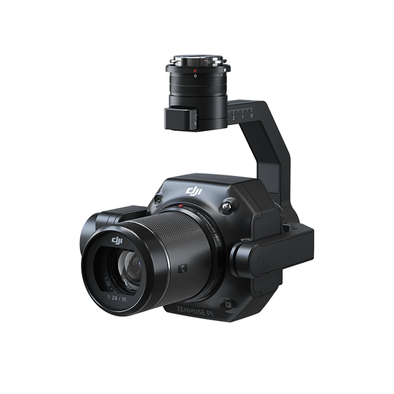
DJI Zenmuse P1 integrates a 45MP full-frame sensor with interchangeable fixed-focus lenses on a 3-axis stabilized gimbal, setting a new benchmark for aerial photogrammetry. Achieving 3 cm horizontal and 5 cm vertical accuracy without GCPs, covering 3 km² in a single flight, and featuring a global mechanical shutter with TimeSync 2.0 synchronization at the microsecond level, the Zenmuse P1 delivers unmatched efficiency, precision, and versatility for professional surveying and mapping operations.
Extraordinary Efficiency – Cover More Ground, Faster
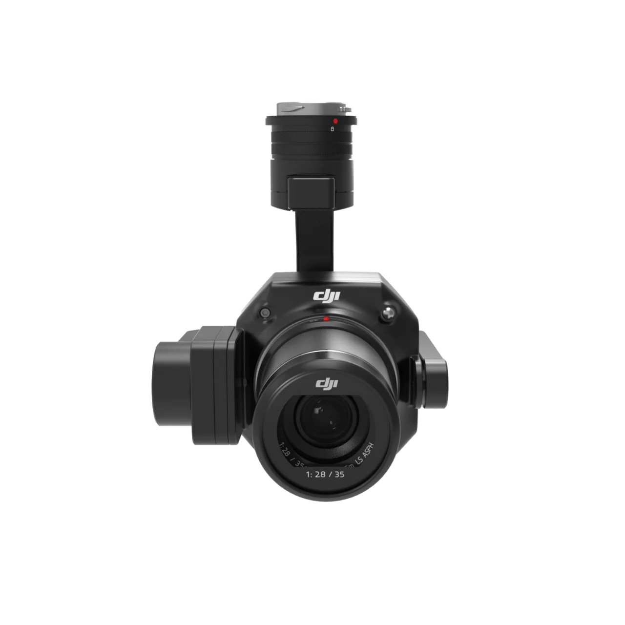
45MP Full-Frame Camera
- 45MP Full-Frame Sensor – Low-noise, high-sensitivity imaging extends daily operational time
- 4.4μm Pixel Size – Exceptional detail capture for centimeter-level accuracy
- 0.7-Second Photo Interval – Rapid continuous capture throughout the entire flight
- 3 km² Coverage per Flight – Maximum area coverage in a single mission
TimeSync 2.0 – Microsecond-Level Synchronization
The all-new TimeSync 2.0 system precisely aligns the camera, flight controller, RTK module, and gimbal at the microsecond level — combined with real-time position and orientation compensation technology, this ensures every image is tagged with pinpoint accuracy for superior post-processing results.
Remarkable Accuracy – Centimeter-Level Without GCPs
- 3 cm Horizontal Accuracy – Without Ground Control Points (GCPs)
- 5 cm Vertical Accuracy – Without Ground Control Points (GCPs)
- Global Mechanical Shutter – Shutter speed up to 1/2000 seconds, eliminating rolling shutter distortion
- Median Exposure Pulse in Microseconds – Ensures maximum timing precision for every captured frame
Robust Versatility – Flexible Lens Options for Every Mission
Multiple Fixed-Focus Lens Options
- 24mm Lens – Wide-angle coverage for large-area topographic mapping and landscape surveys
- 35mm Lens – Balanced field of view for general photogrammetry and cadastral surveying
- 50mm Lens – Narrower FOV for detailed modeling and high-resolution close inspections
- DJI DL Mount Compatibility – Quick and reliable lens swapping between missions
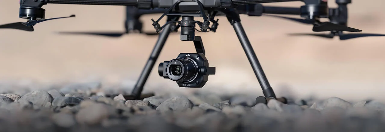
3-Axis Stabilized Gimbal
The integrated 3-axis stabilized gimbal ensures consistent image quality and stability regardless of flight conditions, enabling accurate 2D, 3D, and detailed oblique model creation across all supported lens configurations.
Smart Oblique Capture – Work Smart, Work Fast
Smart Oblique Capture automatically rotates the gimbal to capture photos at all required angles, eliminating the need for manual angle adjustments mid-flight. Only essential photos are captured at the edges of the flight area, increasing post-processing efficiency by 20% to 50%. Cover up to 7.5 km² in a single workday with the Zenmuse P1.
- Automatic Gimbal Rotation – Captures all required oblique angles without pilot intervention
- Edge Optimization – Only essential boundary photos are taken, reducing redundant data
- 20%–50% Post-Processing Efficiency Increase – Significantly reduces office processing time and costs
- 7.5 km² per Workday – Industry-leading oblique photogrammetry coverage rate
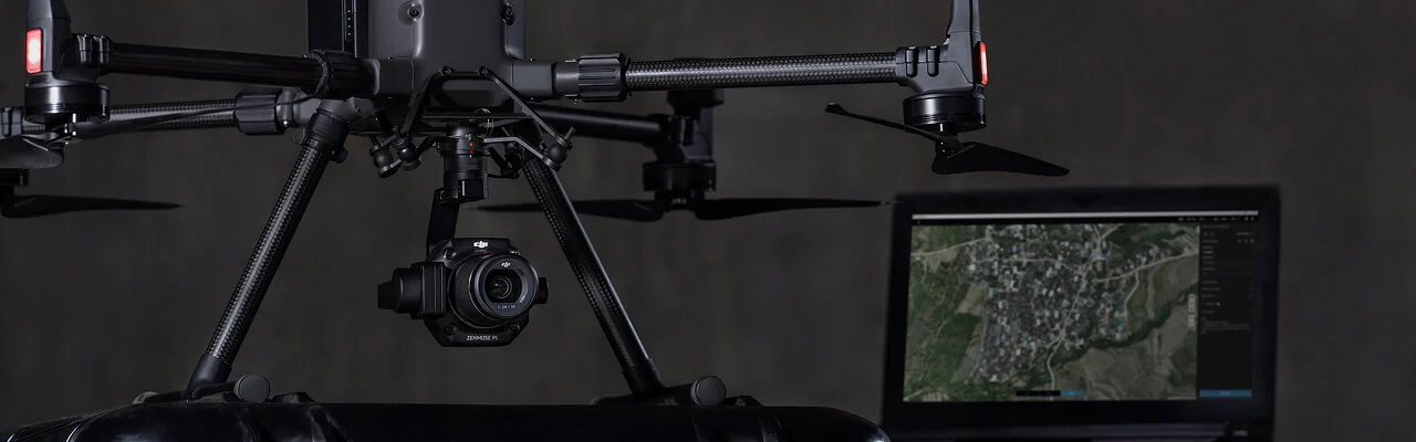
Smart Data Management – Streamlined Mission Workflows
- Automatic File Association – Mission result files are automatically linked to Mission Name and Mission Time
- Centralized Data Storage – Photos, GNSS data, and TimeStamps.MRK files stored in a single, organized location
- Rich Image Metadata – Each image contains camera intrinsic/extrinsic parameters and RTK status
- Fieldwork Report – Instantly verify data quality post-flight by reviewing position data, image count, RTK status, and positioning accuracy
Mission Modes for Every Scenario
- 2D Orthomosaic Mission – Precise top-down mapping for land management and planning applications
- 3D Oblique Mission – Multi-angle image capture for comprehensive 3D reality model reconstruction
- Detailed Modeling Mission – High-resolution close-range data collection for AEC and infrastructure projects
Application Scenarios
- Topographic Mapping – Capture data meeting 1:500 scale accuracy requirements without GCPs
- Cadastral Surveying – Quickly generate centimeter-level accurate 3D reality models for land registration
- AEC and Surveying – Manage the full project lifecycle with 2D and 3D drone data for construction and engineering
- Natural Resource Management – Measure, classify, and determine ownership of water bodies and forests
- Geological Investigation – Safely gather millimeter-level accurate aerial data of geological hazard sites
- Disaster Site Modeling – Real-time overview of vast disaster-struck areas to support critical decision-making