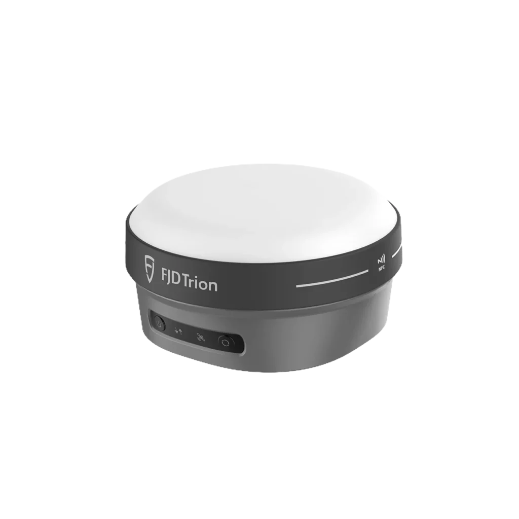
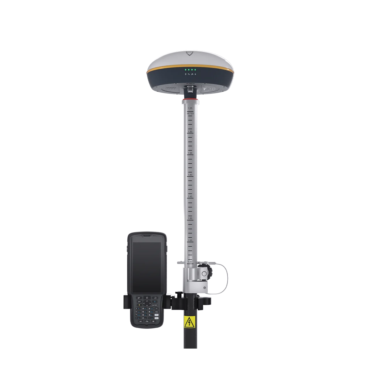

FJD Trion V1t is a versatile and lightweight GNSS RTK receiver with built-in IMU tilt compensation, delivering fast and accurate positioning in harsh environments with global multi-constellation signal coverage. Featuring H: 8mm + 1ppm RTK accuracy, 60° tilt survey (2.5 cm @30°), 20-hour rover battery life, IP67 waterproof protection, 1.5m drop resistance, and an internal UHF radio with up to 5W transmission — the V1t frees operators from bubble-leveling and simplifies field measurement for road construction, resource exploration, precision agriculture, and marine surveying.
Tilt Survey with Built-in IMU
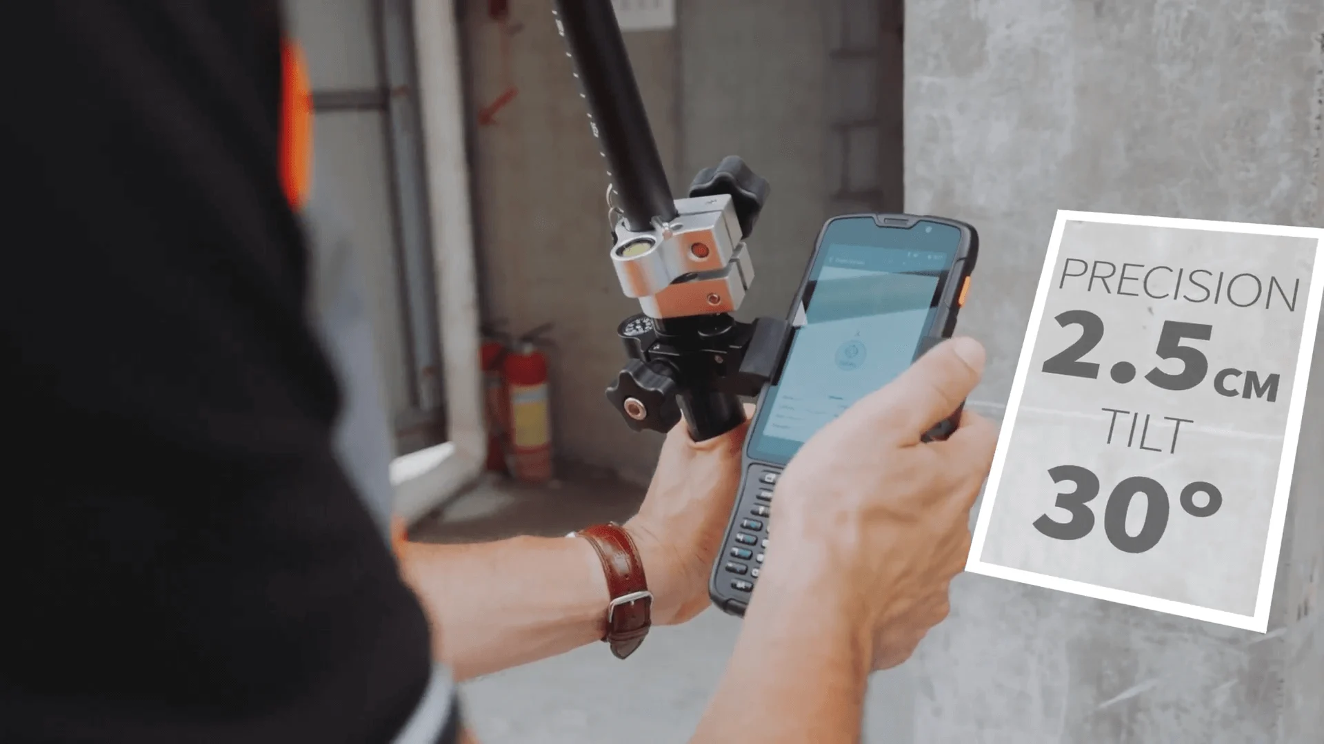
The FJD Trion V1t integrates an Inertial Measurement Unit (IMU) supporting tilt surveys up to 60°, delivering 2.5 cm horizontal accuracy at 30° tilt. Operators no longer need to watch and level the bubble — simply point the pole and measure, dramatically increasing efficiency in obstructed terrain, ditches, and hard-to-reach positions.
Multi-Constellation GNSS Tracking
- GPS: L1C/A, L1C, L2C, L2P(Y), L5
- BeiDou: B1I, B2I, B3I, B1C, B2a, B2b
- GLONASS: G1, G2, G3
- Galileo: E1, E5a, E5b, E6
- QZSS: L1C/A, L1C, L2C, L5, L6
- NavIC: L5 | SBAS: L1C
- PPP: E6 (±20 cm H / ±40 cm V)
Professional-Grade Positioning Accuracy
- RTK: H: 8mm + 1ppm / V: 15mm + 1ppm RMS — Initialization <5s, reliability >99.9%
- High Precision Static: H: 2.5mm + 0.1ppm / V: 3.5mm + 0.04ppm RMS
- Post-Processing Static: H: 2.5mm + 0.5ppm / V: 5mm + 0.5ppm RMS
- PPP: H: ±20 cm / V: ±40 cm RMS
- Carrier Phase Accuracy: ≤1 mm
- Timing Accuracy: 20 ns
Built Tough – IP67 & Drop-Resistant
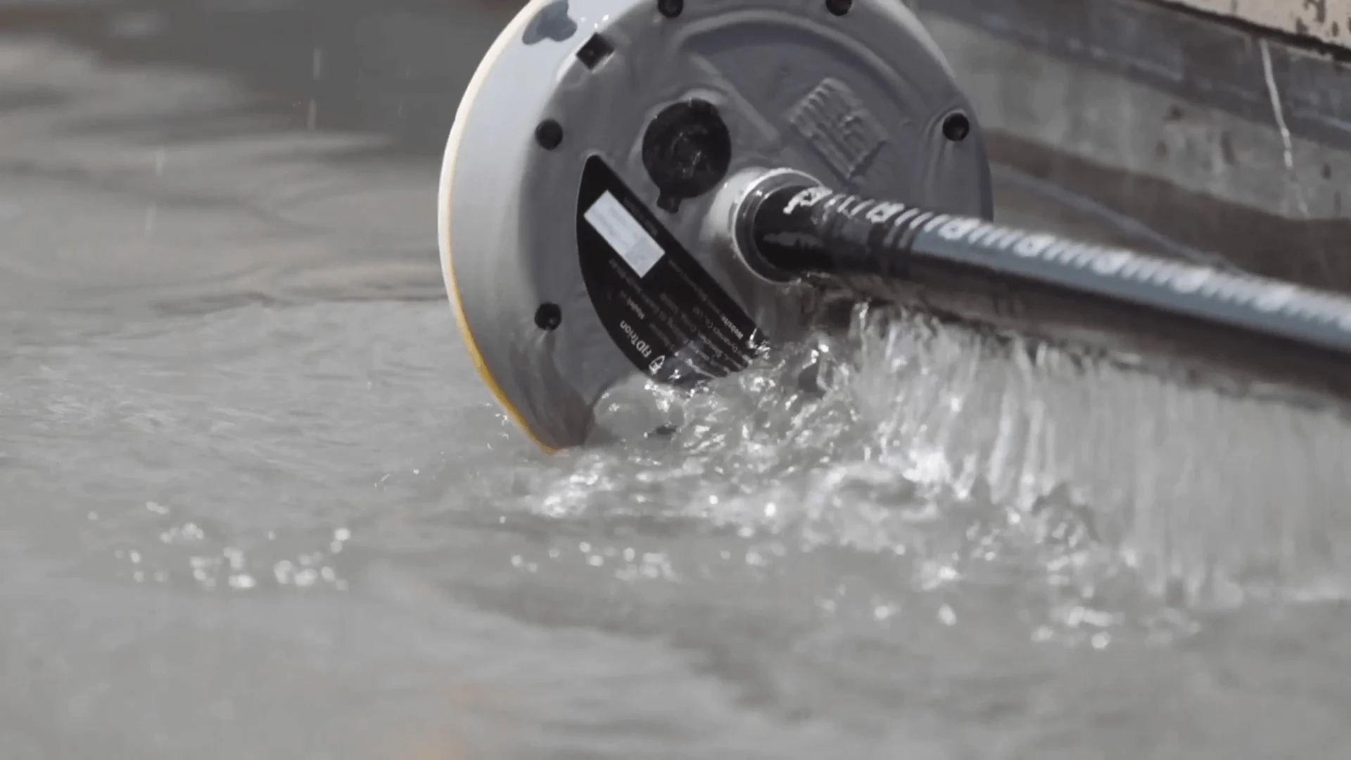
- IP67 Waterproof Protection – Dustproof and submersible for reliable operation in rain, mud, and wet conditions
- 1.5-Meter Drop Resistance – Survives accidental pole-drops in the field
- -30°C to 60°C Operating Temperature – Engineered for extreme environments from freezing cold to desert heat
- 100% Humidity Tolerance (Condensing) – Full performance in tropical and high-moisture environments
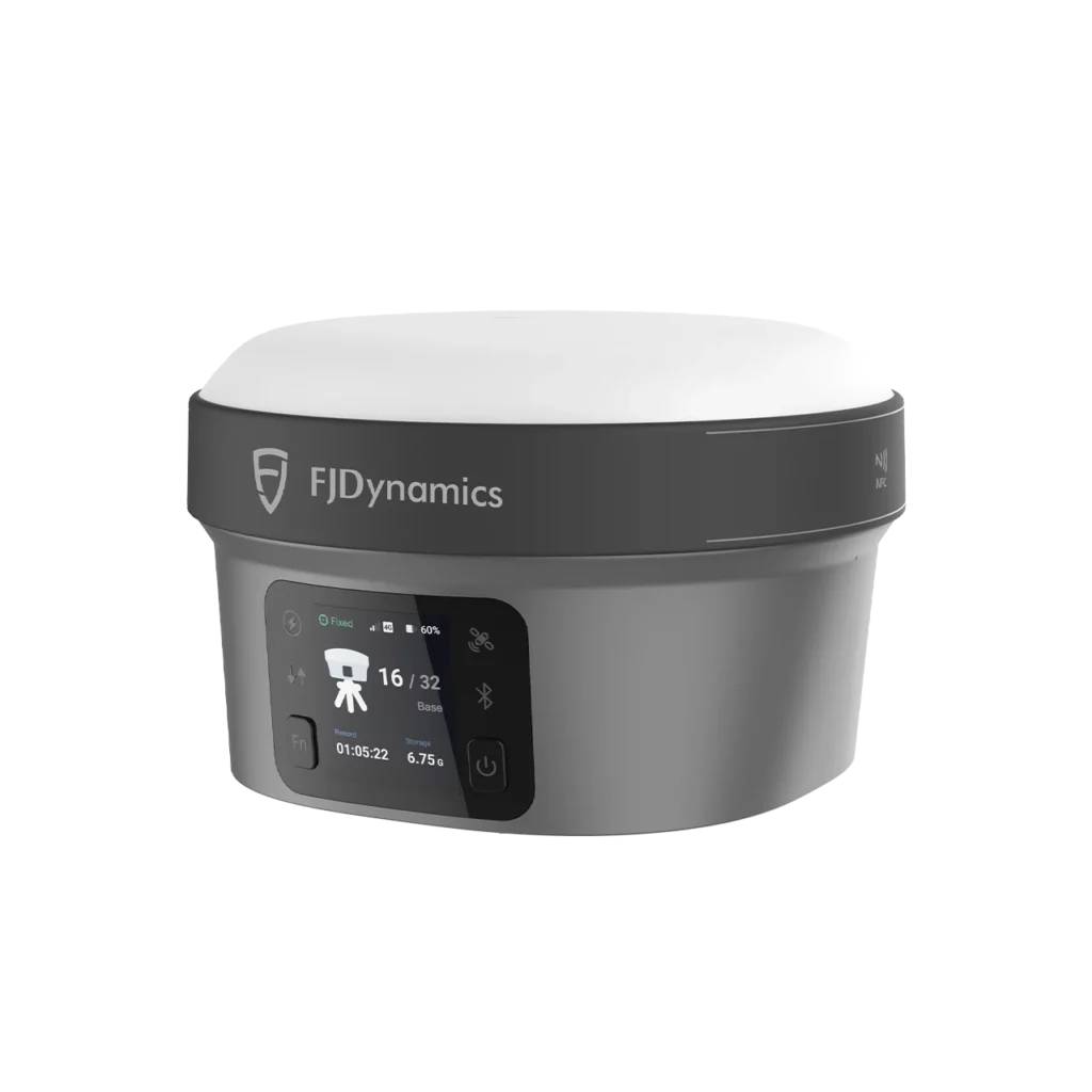
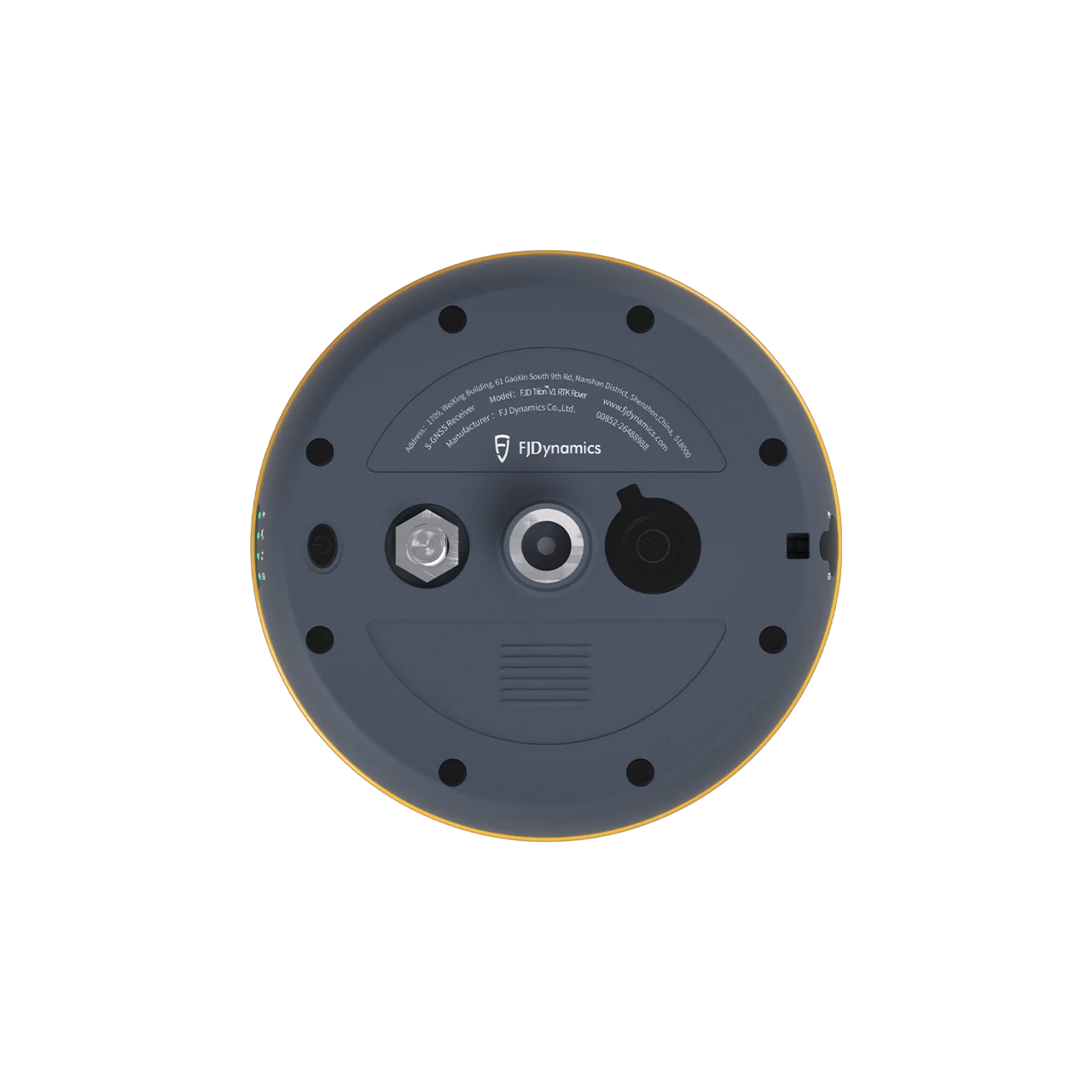
Extensive Connectivity
- Internal UHF Radio – 1W/2W/5W (optional), 410–470 MHz / 902–928 MHz, LoRa/TRIMTALK/TRIMMARK III protocols
- Wi-Fi – IEEE 802.11b/g/n for wireless data transfer
- USB Type-C – With 12V DC fast charge support
- UHF Antenna Port – For external radio connectivity
- Data Formats: RTCM3.X, RTCM2.X, CMR, NMEA-0183
- 32 GB Internal Memory – Ample storage for extended field campaigns
All-Day Battery with Fast Charging
- 6,500 mAh Battery – 20 hours rover / 10 hours base operation
- 30W USB PD Fast Charging – Rapid recharge between sessions
- 9–32V DC External Power – Via aviation plug for continuous base station operation
Optional High-Power External Radio
Pair with the FJ-HPR 400A high-power external radio transceiver — delivering up to 28W transmission power with IP67 durability, app-based configuration, and extended base-to-rover range for demanding surveying and mapping projects.
Application Scenarios
- Road Construction – Stakeout and as-built verification with tilt-compensated measurement along highways and corridors
- Resource Exploration – Precise positioning in remote and rugged terrain for geological and mining surveys
- Precision Agriculture – RTK-grade guidance for field boundary mapping, drainage planning, and machinery control
- Digital Machinery – Machine control integration for excavators, graders, and construction equipment
- Construction – Layout, foundation verification, and progress monitoring across project sites
- Marine – Coastal and offshore positioning with IP67 waterproof protection