
DJI Terra Pro Standard Permanent is professional 3D reconstruction software engineered for aerial survey workflows, supporting 2D and 3D photogrammetry, LiDAR point cloud processing, multispectral reconstruction, terrain result generation, cluster computation, and agricultural applications — in a permanent, single-device license with online and offline authorization. When paired with DJI Enterprise drones and DJI LiDAR payloads, Terra Pro Standard delivers an integrated hardware-software solution for surveying and mapping, public safety, electricity, oil and gas, roads and bridges, and water conservancy.
Standard Edition – Included Features
- Agricultural Application – Prescription maps and vegetation index maps for field and fruit tree crops
- 2D Map Reconstruction (Field/Fruit Tree & Urban) – Full 2D orthomosaic generation across agricultural and urban scenarios
- 2D Multispectral Reconstruction – NDVI, NDRE, and reflectance maps from multispectral drone data
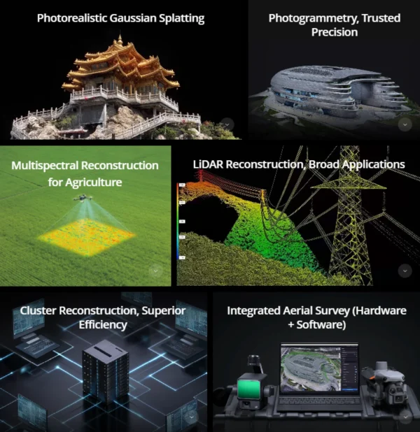
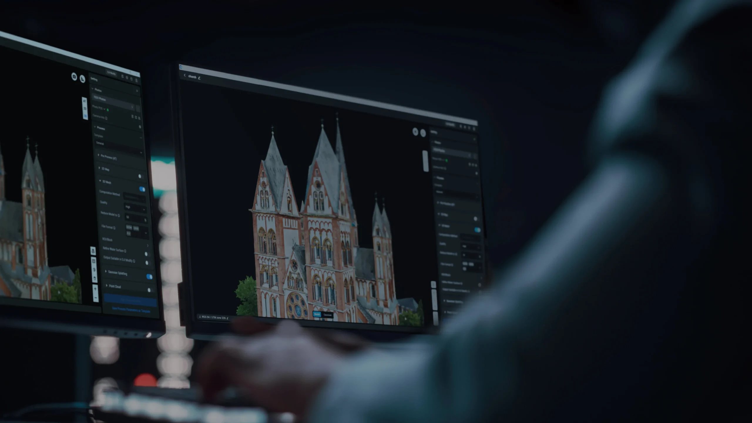
- 3D Mesh Reconstruction – High-fidelity 3D models, point clouds, TDOM, and DSM
- LiDAR Point Cloud Reconstruction – Centimeter-level accuracy from Zenmuse LiDAR payloads
- Terrain Result – DEM, contour, and TIN generation for engineering surveys
- Cluster Computation – Multi-GPU/multi-node acceleration for large-scale reconstruction
- Bind Device: 1 Device | Authorization Mode: Online / Offline
Photogrammetry – Trusted Precision
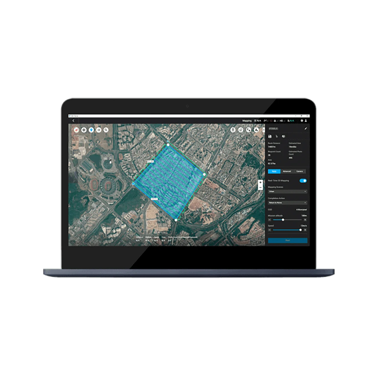
High-Accuracy 1:500 Mapping
DJI Terra Pro Standard achieves centimeter-level accuracy without ground control points by integrating RTK drone data with intelligent algorithms. It supports output of 3D mesh models, point clouds, and 2D maps, consistently meeting 1:500 mapping standards for engineering surveys and topographic mapping — with dedicated accuracy enhancements for DJI Enterprise mapping drones like the Matrice 4E.
High-Fidelity 2D/3D Reconstruction
- True Digital Orthophoto Maps (TDOM) & DSM – High-precision 2D outputs for GIS and planning
- Adjustable Mesh Count & Map Resolution – Fine-tune model quality to project requirements
- Multiple Export Formats – Seamless integration with industry-standard software
Fast, On-Site Results
- Standalone Workstation: 5,000 photos in under 2 hours (2D); up to 30,000 photos in 3 days (3D)
- Cluster Reconstruction: 30,000 photos in 21 hours | 5,000 photos in 80 minutes
- Real-Time On-Site Processing – Generate results immediately for smaller projects
LiDAR Reconstruction – Broad Applications
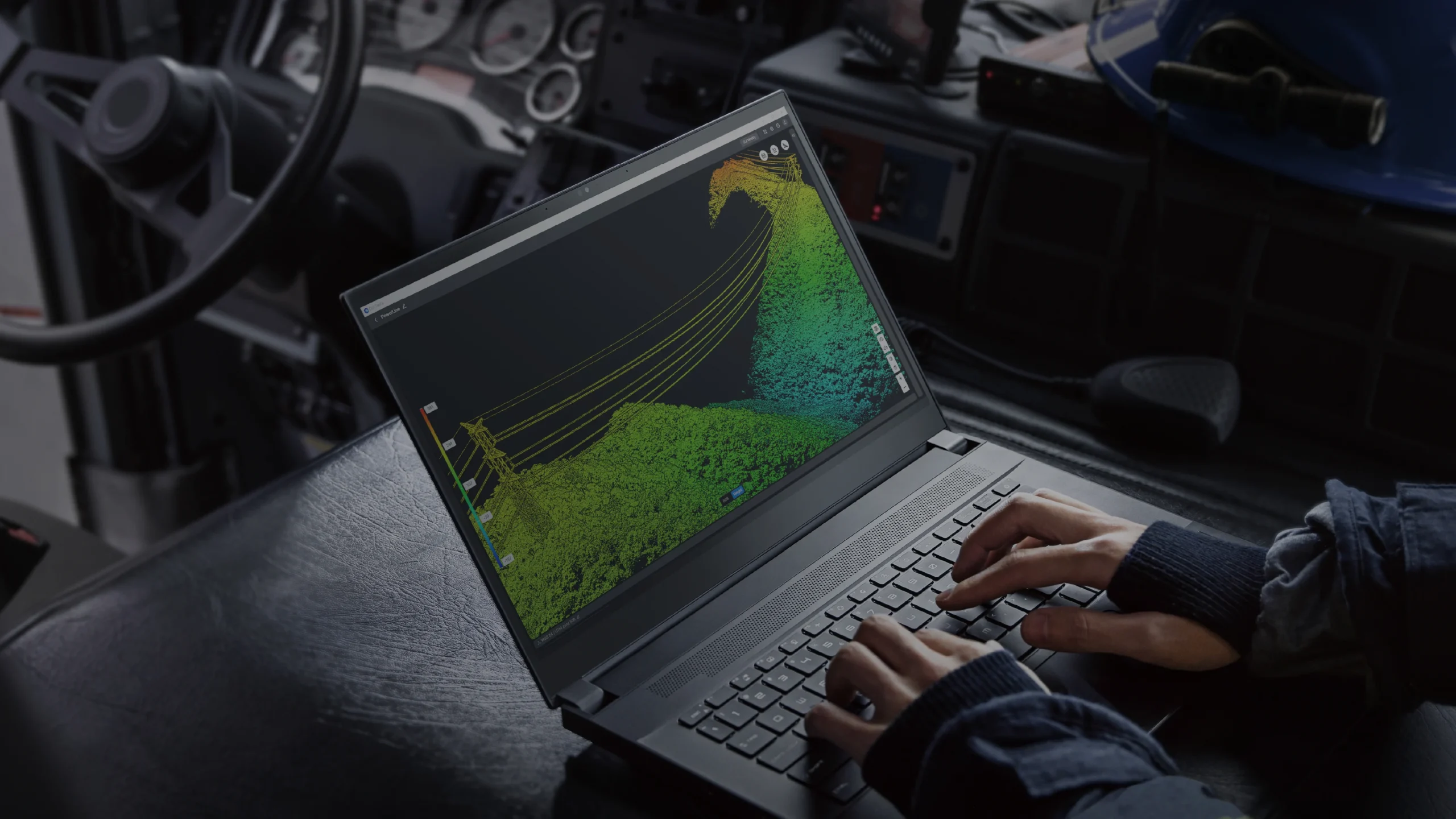
2D-3D Data Fusion Modeling
With a single Zenmuse LiDAR acquisition, Terra Pro Standard simultaneously generates high-precision point clouds, 2D maps, and 3D mesh models. This data fusion approach enhances model completeness in complex environments such as bridges and substations.
Centimeter-Level Accuracy via RTK & PPK
Processes LiDAR point cloud data from Zenmuse payloads to achieve survey-grade accuracy without GCPs, supporting RTK, local PPK, and cloud-based PPK workflows.
Large-Scale LiDAR Data Support
- ~1 GB Point Cloud per 1 GB RAM – Efficient large-scale dataset handling
- Up to 120 GB of data on 32 GB RAM – Covering approximately 10 km²
- Up to 128 GB RAM workstation support – For city-scale LiDAR processing
Multispectral Reconstruction for Agriculture
- NDVI & NDRE Vegetation Index Maps – Actionable insights into plant growth and health from DJI Mavic 3 Multispectral and Phantom 4 Multispectral
- Radiometric Correction & Reflectance Maps – For remote sensing research workflows
- Prescription Maps – For field and fruit tree crops with optimized route planning for DJI Agras drones
- Variable-Rate Spraying Maps – Reduce costs and improve crop yields with intelligent spraying routes
Cluster Computation – Superior Efficiency
- 6,000 Photos per 1 GB RAM – Cluster reconstruction overcomes single-machine limitations
- 5 Worker Devices = 30,000 Photos in 21 Hours – Exponential efficiency with scalable node count
- Multi-GPU & Multi-Node Collaboration – Ideal for city-scale 3D modeling and large aerial survey tasks
Advanced Features
- PPK Calculation – Local PPK for visible light; local and cloud-based PPK for LiDAR
- Control Points & Check Points – Semi-automatic GCP marking with sub-pixel accuracy for precise model calibration
- 8,500+ Coordinate Systems – Local systems, seven-parameter transformations, PRJ file imports with intelligent recommendation
- Annotation & Measurement – Points, lines, areas, and volumes with camera position linking and multi-format export
- DJI Terra + DJI Modify Integration – One-click handoff to Modify for intelligent 3D model editing, GIS/CAD export
Application Scenarios
- Surveying & Mapping – 1:500 accuracy topographic mapping without GCPs
- Public Safety – Rapid scene modeling for emergency response and situational awareness
- Oil & Gas – Pipeline corridor monitoring and facility inspection with LiDAR fusion
- Roads & Bridges – Detailed infrastructure documentation and structural inspection
- Water Conservancy – Terrain modeling for dam and reservoir management
- Agriculture – Prescription map generation and variable-rate spraying for Agras drones