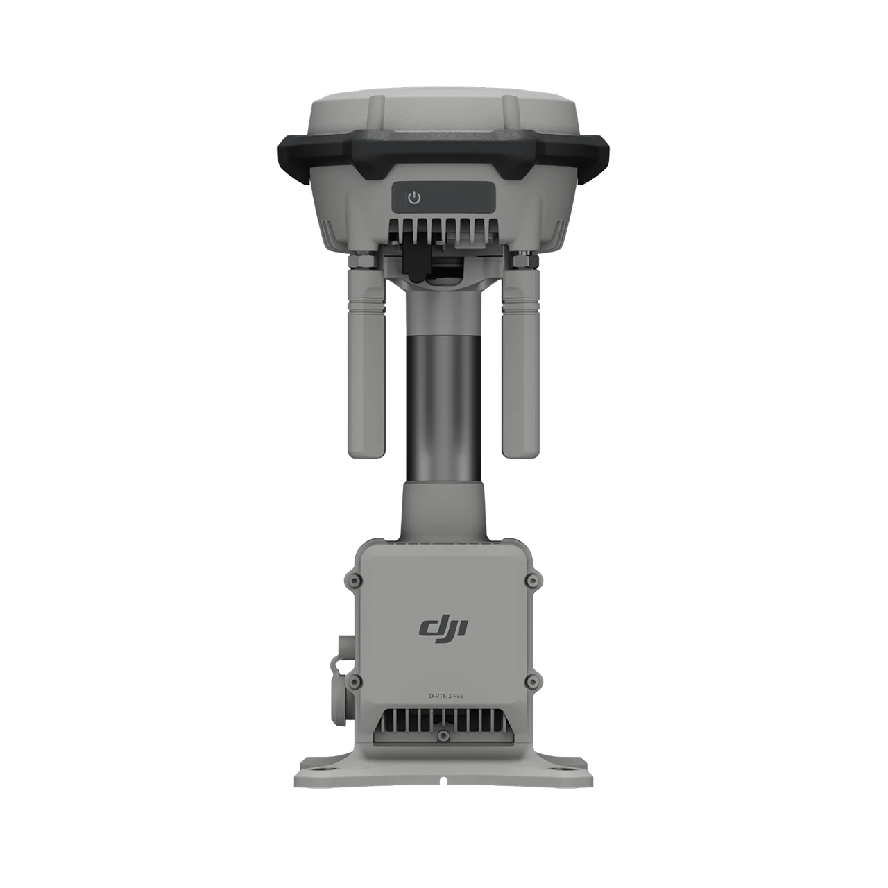
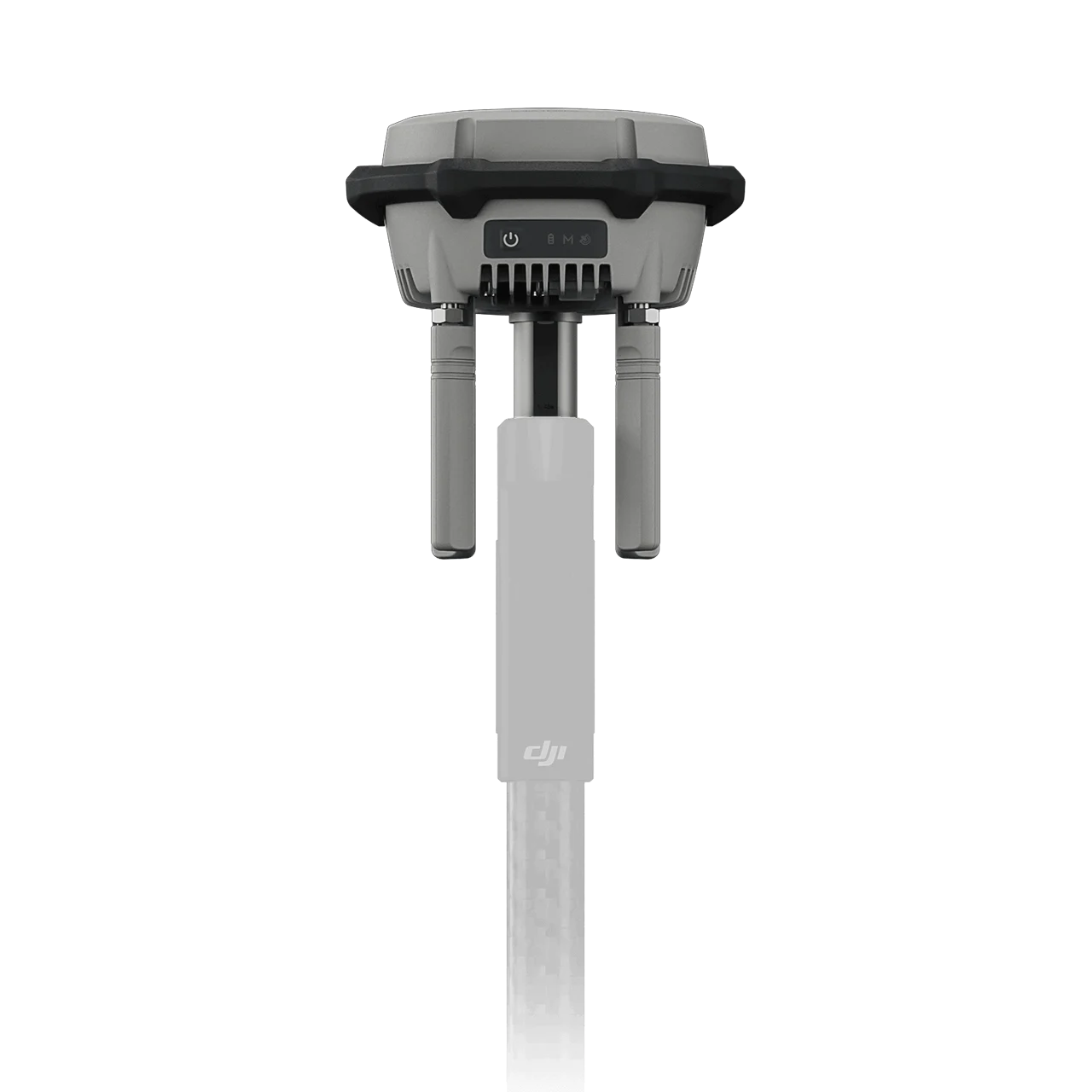
D-RTK 3 Multifunctional Station is DJI’s latest high-precision positioning and relay system that integrates high-performance antennas and receiver modules tracking major global satellite navigation systems across 19 frequency points. This versatile station operates in three modes: Base Station Mode providing centimeter-level RTK positioning for multiple drones simultaneously with 40 km coverage, Relay Station Mode extending drone operational range up to 25 km in obstructed environments, and Rover Station Mode for ground control point collection with tilt compensation. Featuring millimeter-level antenna phase-center accuracy, air dielectric antenna with multipath interference resistance, Standalone PPP for decimeter-level positioning, and Network High-Precision Calibration, the D-RTK 3 ensures reliable positioning in challenging conditions. Compatible with DJI Enterprise app for GCP setup, projection coordinate conversion, and seamless DJI Terra integration supporting local PPK processing.
Multiple Modes, Versatile Control – One Station, Three Functions
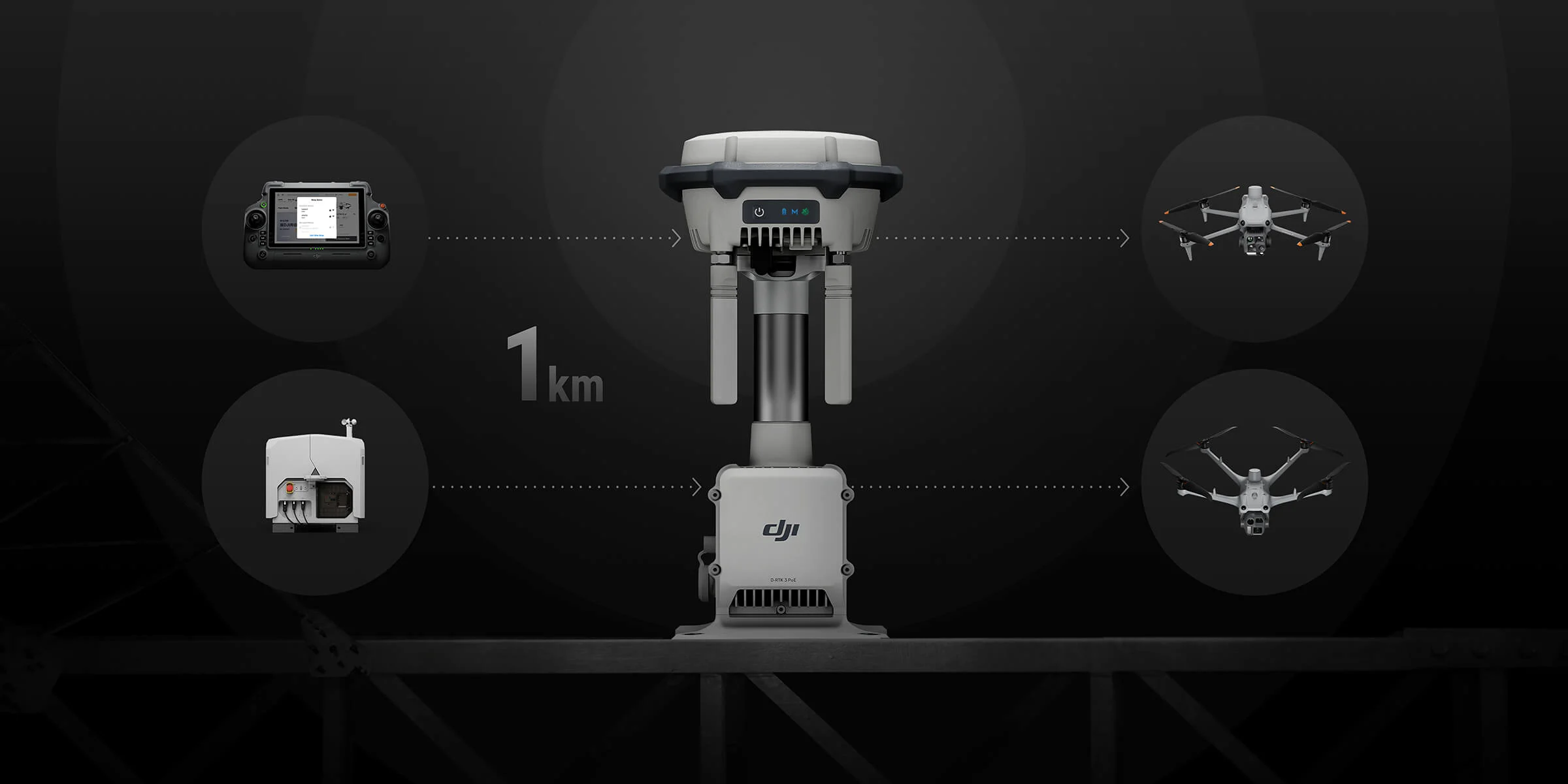
Relay Station Mode – Break Through Limitations
- 25 km Extended Operational Coverage – Enhances video transmission range for drones in urban areas, valleys, or challenging DJI Dock 3 sites
- Obstruction Sensing Integration – Real-time calculations of obstructions and signal quality between relay station, remote controller, and drone
- High Point Deployment – Position at elevated locations to overcome dense obstacles
- D-RTK 3 Relay Fixed Deployment Version – Maintenance-free outdoor operation on towers, utility poles, parapet walls
- Remote Access Capability – Matrice 4 Series drones can scan and connect to idle relay stations automatically
Base Station Mode – Simultaneous Multi-Drone Operation
- 40 km Maximum RTK Coverage Range – Four external directional antennas ensure stable signals in all directions
- Multi-Drone Centimeter-Level Positioning – Single station supports multiple drones without additional configuration
- O4 Enterprise Video Transmission Support – Compatible with latest DJI enterprise drone systems
- Plug-and-Play Setup – No complex configuration required for immediate operation
Rover Station Mode – Flexible Ground Control
- Ground Control Point Collection – Efficient GCP measurement without third-party tools
- Tilt Compensation – High-precision IMU allows angled pole measurements without tripod
- Bluetooth 5.1 Connectivity – Compatible with Android 10+ devices via DJI Enterprise app
- Projection Coordinate Conversion – Direct output of planar coordinates from mainstream projection database
Maintenance-Free Relay Fixed Deployment – Adaptable to Any Environment
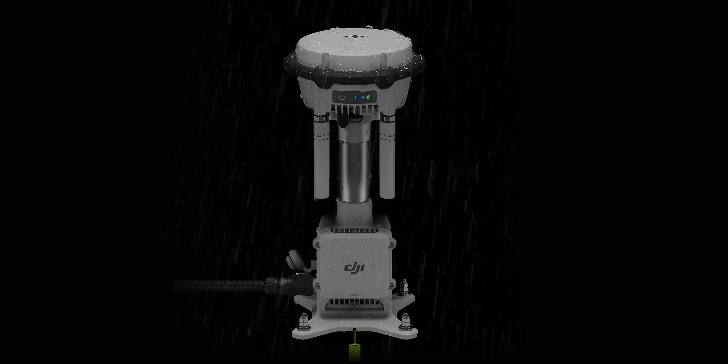
Robust Outdoor Performance
- IP67 Protection Rating – Superior dust and water resistance for permanent installations
- -30°C to 50°C Operating Range – Extreme temperature reliability
- Lightning Surge Protection – Safeguards against electrical surges
- Highly Redundant Hardware/Software – Significantly reduced maintenance costs
Flexible Installation Options
- Vertical Structure Mounting – Towers, utility poles, parapet walls
- DJI Dock 3 Power Supply – Seamless integration with autonomous docking stations
- Third-Party PoE Sources – Long-distance power deployment flexibility
- Minimal Intervention Required – Continuous outdoor operations with low maintenance
Effortless High-Precision Positioning – Stronger Performance, More Accurate Results
Advanced Antenna Technology
- Air Dielectric Antenna – Filtering design effectively tracks low-elevation satellites
- Millimeter-Level Phase-Center Accuracy – Superior positioning precision
- Strong Multipath Interference Resistance – Reliable performance in complex urban environments
Comprehensive Satellite Coverage
- Five Major Satellite Systems – GPS, GLONASS, BeiDou, Galileo, QZSS
- 19 Frequency Points – Maximum satellite tracking capability
- Superior to Network RTK – More accurate and stable positioning under ionospheric effects
Standalone Precise Point Positioning (PPP)
- DJI Proprietary PPP Solution – Decimeter-level positioning without base station
- Satellite-Based Augmentation – BeiDou B2b and Galileo HAS integration
- Network-Independent Operation – Reliable positioning in remote areas
Network High-Precision Calibration
- RTCM Data Reception – Automatic coordinate acquisition and position correction
- Centimeter-Level Outdoor Precision – No pre-measured setup point required
- Seamless Network Integration – Works with existing CORS networks
DJI Integrated Mapping Solution – Complete Workflow Efficiency
New DJI Enterprise App
- Ground Control Point (GCP) Setup – Complete measurement without third-party tools
- Tilt Compensation Support – Measure control points with angled pole, no tripod needed
- Projection Coordinate Database – Direct planar coordinate output
- Bluetooth 5.1 Connectivity – Android 10+ device compatibility
- One-Click GCP Export – Seamless DJI Terra integration
Seamless DJI Terra Integration
- One-Click Import – Rover results exported as control point files, no format adjustments needed
- Local PPK Processing – DJI Terra 4.4+ supports one-click PPK calculations with Matrice 4E data
- High-Precision Results – Powerful algorithms generate survey-grade outputs
- Complete Surveying Workflow – From GCP collection to final deliverables
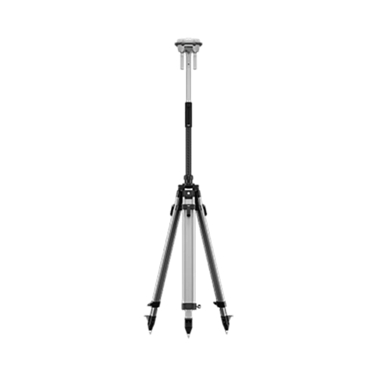
Professional Accessories
- Self-Locking Survey Pole – Quick, secure deployment
- Dual-Lock Tripod – Stable base station mounting
- Weather-Resistant Design – Field-ready construction
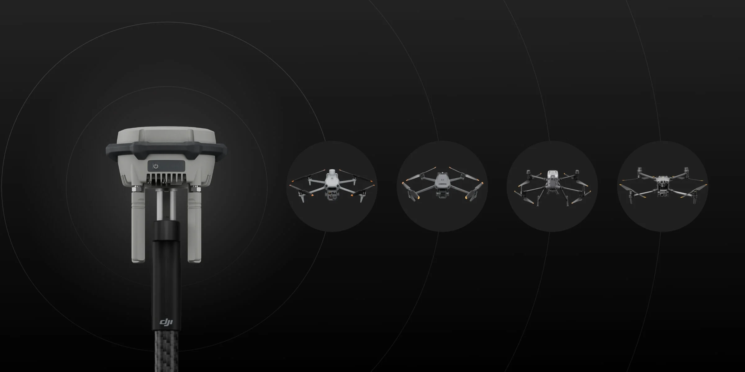
Extensive Model Compatibility
Base Station Mode
- Enterprise Series – Matrice 400, Matrice 4E/4T, Matrice 4D/4TD, Matrice 3D/3TD, Matrice 300/350 RTK, Matrice 30 Series, Mavic 3 Enterprise Series, DJI FlyCart 100/30
- Agriculture Series – T60, T50/T25, T40/T20P
- Professional Filmmaking – DJI Inspire 3 (manual calibration)
Relay Station Mode
- Matrice 400, Matrice 4E/4T, Matrice 4D/4TD, DJI FlyCart 100
Rover Station Mode
- Bluetooth 5.1 Compatible – Android 10+ devices via DJI Enterprise app
Application Scenarios
- High-Precision Aerial Surveying – Topographic mapping, construction site surveys, volumetric calculations
- Urban Drone Operations – Signal relay for BVLOS flights near high-rise buildings
- Challenging Terrain Mapping – Mountainous areas, valleys, forested regions
- Multi-Drone Fleet Operations – Simultaneous RTK positioning for coordinated missions
- Ground Control Point Networks – Permanent GCP establishment for repeated surveys
- RTK Network Extension – Coverage enhancement in remote areas
Key Advantages Over Previous Generations
- 40 km RTK Coverage – Double the range of D-RTK 2
- 25 km Relay Extension – New relay capability for obstructed environments
- Three Operation Modes – Base, Relay, and Rover functionality
- O4 Enterprise Compatibility – Future-proof for latest transmission systems
- Tilt Compensation – No-leveling measurements improve efficiency
- IP67 Fixed Deployment – Permanent outdoor installations