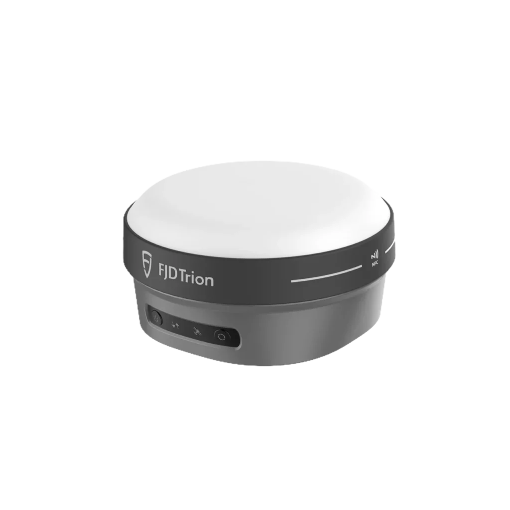
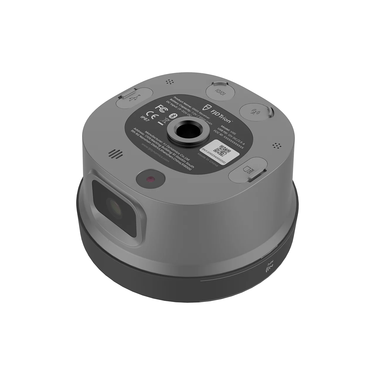

FJD Trion V10i is an advanced RTK GNSS receiver with integrated visual positioning, combining 1408-channel multi-constellation tracking, AR Stakeout, Visual Measure, built-in IMU tilt compensation, dual cameras (2MP forward + 5MP downward with global shutter), and a true-color OLED screen — delivering a next-level productivity boost for surveyors. Featuring H: 8mm + 1ppm RTK accuracy, 3 cm Visual Measure accuracy, 60° tilt survey, IP68 waterproof protection, 2m drop resistance, and 15-hour rover battery life, the V10i redefines field surveying for cadastral, construction, topographic, and infrastructure applications.
AR Stakeout – Real-Time Visual Guidance
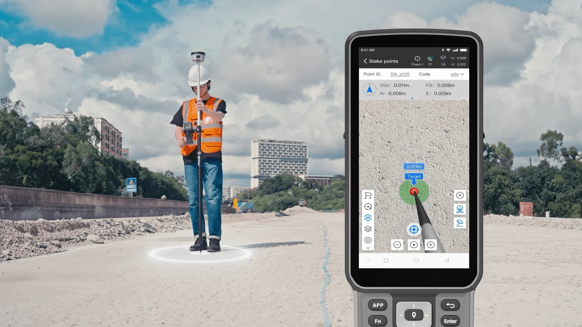
The FJD Trion V10i transforms traditional stakeout workflows. Two HD cameras provide a clear real-time video view during stakeout, with the target point location displayed directly in the video feed. Real-time directional guidance allows operators to find stakeout points quickly and intuitively — powered by a 4-core processor and multi-engine algorithm for smooth, responsive AR imagery.
Visual Measure – Measure the Inaccessible
The Visual Measure function enables measurement of hard-to-access or dangerous locations. After capturing at least 5 high-definition photos, centimeter-level coordinates (typically 3 cm accuracy, 2–15 m range) can be obtained simply by clicking on points in the photos — eliminating the need for physical access to hazardous positions.
60° Tilt Survey with Built-in IMU

The V10i supports tilt surveys up to 60°, delivering 2.5 cm horizontal accuracy at 30° tilt. No need to hold the survey pole upright — the IMU automatically compensates tilted angles, dramatically improving measurement efficiency in obstructed terrain, ditches, and awkward positions.
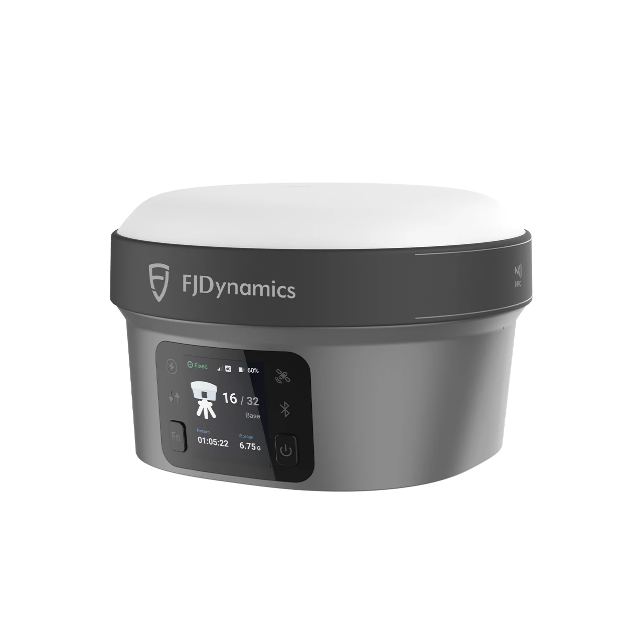
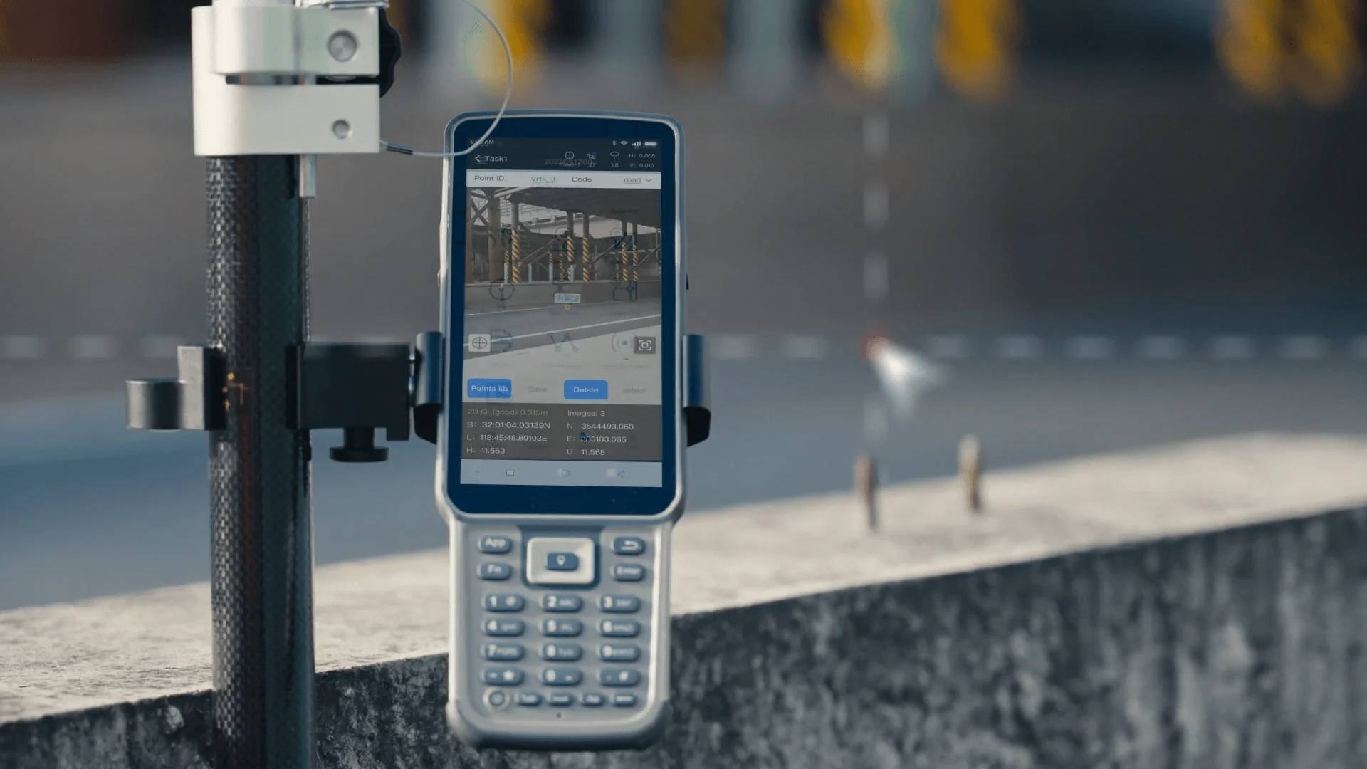
Smart OLED Interaction
- 1.41″ True-Color OLED Screen – Real-time working status display, readable even under strong sunlight
- Physical Button Control – Set base station and static modes without a controller
- Noise-Canceling Microphone – 98% speech recognition accuracy for voice-controlled operation
- Hi-Fi Speakers – Audio broadcast of working status, satellite lock, and measurement confirmation
1408-Channel Multi-Constellation GNSS
- GPS: L1C/A, L1C, L2C, L2P, L5
- GLONASS: L1, L2
- BeiDou: B1I, B2I, B3I, B1C, B2a, B2b
- Galileo: E1, E5a, E5b, E6
- QZSS: L1, L2C, L5, L6
- IRNSS & SBAS: Support via firmware upgrade
Professional Positioning Accuracy
- RTK: H: 8mm + 1ppm / V: 15mm + 1ppm RMS — Initialization <5s, reliability >99.9%
- Visual Survey: Typically 3 cm (2–15 m range)
- Post-Processing Static: H: 2.5mm + 0.5ppm / V: 5mm + 0.5ppm RMS
- Code Differential: H: 0.4m / V: 0.8m RMS
- Positioning Rate: 1 Hz, 5 Hz, 10 Hz
Built Tough – IP68 & Drop-Resistant
- IP68 Waterproof Protection – Dustproof, protected from continuous immersion to 1 meter depth
- 2-Meter Pole-Drop Survivability – Engineered to withstand accidental falls in the field
- -30°C to 60°C Operating Temperature – Reliable performance in the harshest outdoor conditions
- Lightweight Alloy Body – Magnetic interference resistant with stable satellite reception
- ~1 kg / Φ130 × 83 mm – Compact and ergonomic for all-day field use
Extensive Connectivity
- Built-in 4G Modem – TDD-LTE, FDD-LTE, WCDMA, EDGE, GPRS, GSM for universal NTRIP connectivity
- Wi-Fi (2.4 & 5 GHz, 802.11a/b/g/n/ac) – High-speed wireless data transfer
- NFC Touch Pairing – Instant device connection
- Built-in UHF Radio – 1W (2W optional), TRIMTALK/TRIMMARK III/LoRa, 6–12 km typical range
- 7-pin LEMO + USB Type-C + UHF Antenna Port – Full wired connectivity
- 32 GB Internal Memory – 20 GB available for field data
All-Day Battery with Fast Charging
- 7,000 mAh Built-in Battery – 7.4V Li-ion with 30W PD Fast Charge
- 15 Hours Rover / 10 Hours Base / 25+ Hours Static – Full-day operation
- 9–28V DC External Power Input – Extended operation via external source
Application Scenarios
- Cadastral Survey – High-accuracy boundary delineation with AR Stakeout and Visual Measure
- Construction – AR CAD overlay and point staking for on-site layout and quality control
- Topographic Survey – Tilt-compensated terrain measurement for elevation models and surface mapping
- River & Coastline – IP68 waterproof design for wet-environment surveying and coastal mapping
- Bridges & Roads – Visual Measure for inaccessible structural points without physical access
- Utility Infrastructure – Underground and overhead utility mapping with centimeter-level visual positioning