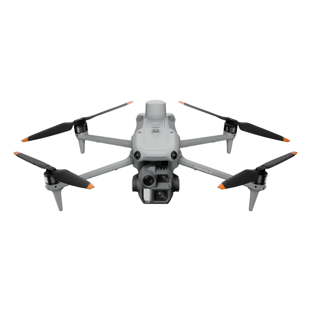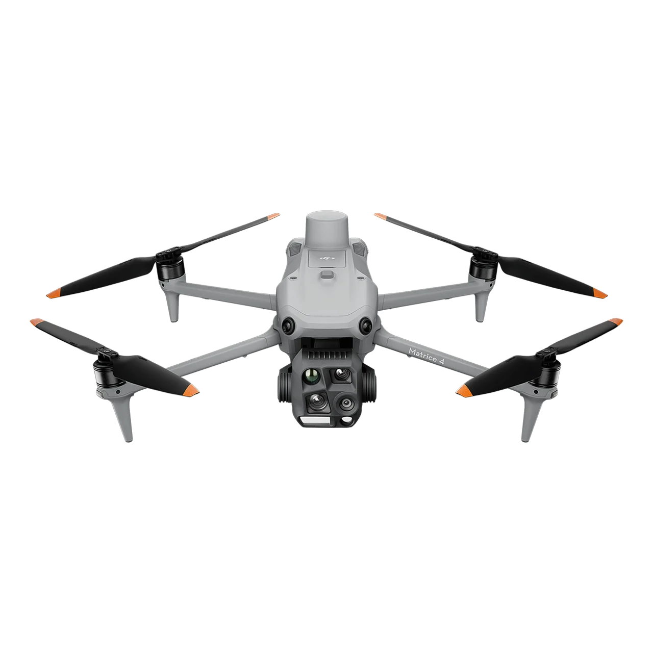
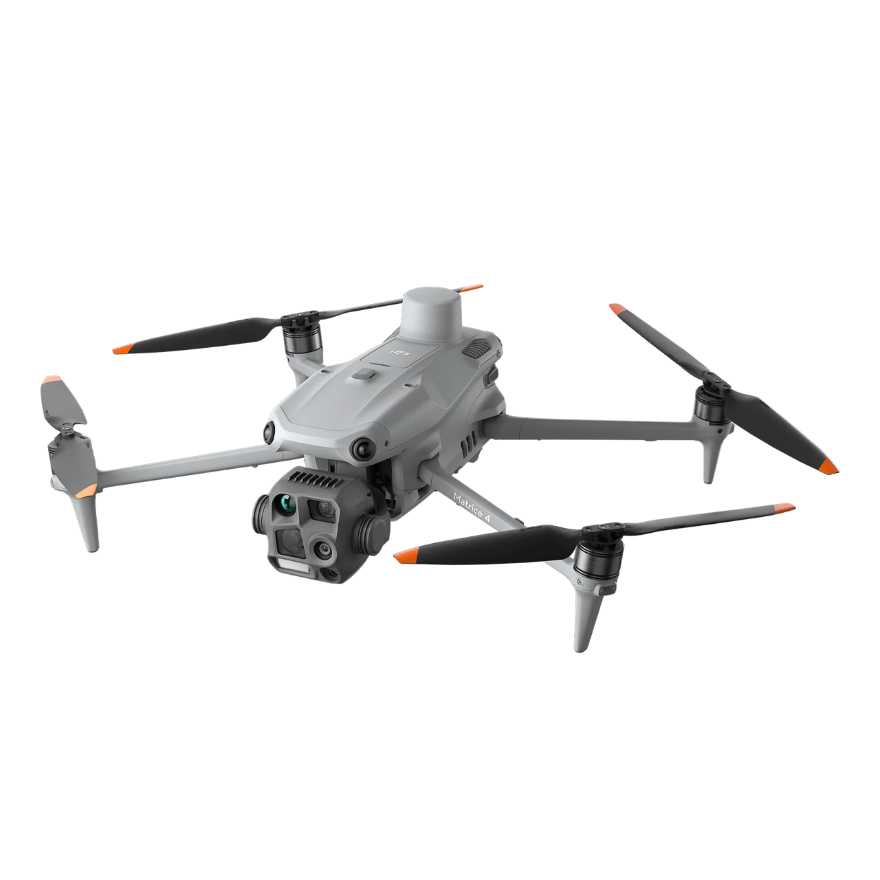
DJI Matrice 4T is a flagship intelligent multi-sensor compact drone specifically engineered for thermal inspections, emergency response, public safety, electricity infrastructure monitoring, and forestry conservation operations. Equipped with advanced multi-sensor payload including 48MP wide-angle camera with f/1.7 aperture, 48MP medium tele camera, 48MP tele camera, 640×512 infrared thermal camera with High-Res Mode (up to 1280×1024 resolution), NIR auxiliary light with 100m illumination distance, and laser range finder, the Matrice 4T delivers exceptional 24/7 operational capability. With O4 Enterprise video transmission extending up to 25 km range, six high-definition low-light fisheye vision sensors, integrated RTK positioning, and comprehensive intelligent detection functions, this thermal imaging drone redefines professional aerial operations for critical missions in challenging environments.
Advanced Multi-Sensor Thermal Imaging System
48MP Wide-Angle Camera
- 1/1.3-inch CMOS Sensor – High-quality imaging for detailed documentation
- 48MP Effective Pixels – Superior resolution for comprehensive scene capture
- f/1.7 Large Aperture – Exceptional low-light performance for night operations
- 24mm Format Equivalent – Wide field of view for situational awareness
- Smart Low-Light Photo – Intelligent low-light capabilities for dusk and nighttime missions
48MP Medium Tele Camera
- 1/1.3-inch CMOS Sensor – Professional imaging performance
- 48MP Effective Pixels – Exceptional detail capture
- f/2.8 Aperture – Balanced performance across lighting conditions
- 70mm Format Equivalent – Detects screws and cracks from 10 meters, clearly reads instrument data at substations
- Foreground Stabilization – Keeps subjects stable and clear during telephoto shooting at 10x zoom or higher
48MP Tele Camera with IR-Cut Filter
- 1/1.5-inch CMOS Sensor – High-resolution long-range imaging
- 48MP Effective Pixels – Captures details like signs from up to 250 meters away
- f/2.8 Aperture – Superior telephoto performance
- 168mm Format Equivalent – Long-distance inspection capability
- IR-Cut Filter – Enables black-and-white night vision mode for 24/7 operations
- Enhanced Clarity – Significantly improved image quality for detailed inspections
640×512 Infrared Thermal Camera
- 640×512 Resolution – High-definition thermal imaging for precise temperature mapping
- f/1.0 Aperture – Maximum thermal sensitivity for detecting minute temperature differences
- 53mm Format Equivalent – Optimal field of view for thermal inspections
- Uncooled VOx Microbolometer – Reliable thermal sensor technology for consistent performance
- High-Res Mode – Ultra-high resolution thermal images up to 1280×1024 for detailed temperature analysis
- Ultra-High Resolution – Reveals small temperature details for various inspection operations
- Temperature Accuracy Calibration – Each device undergoes factory calibration for precise measurements
- Onboard Temperature Sensor – Provides real-time ambient temperature compensation
NIR Auxiliary Light
- 100m Illumination Distance – Extended night vision capability for search and rescue operations
- 6° Field of View – Focused illumination beam for targeted lighting
- Enhanced Night Operations – Ensures clear visibility of objects in complete darkness
- Wildlife Protection Applications – Non-disturbing illumination ideal for forestry conservation
Laser Range Finder
- 1800m Measurement Range – Long-distance precision measurement at 1 Hz frequency
- 600m Oblique Incidence Range – 1:5 oblique distance measurement capability
- 1m Blind Zone – Minimal dead zone for versatile applications
- Range Accuracy – ± (0.2 + 0.0015 × D) meters for reliable distance data
- Real-Time Precise Measurement – Pin point, line drawing, and area calculation including wildfire area measurement
Superior Night Vision and 24/7 Operations
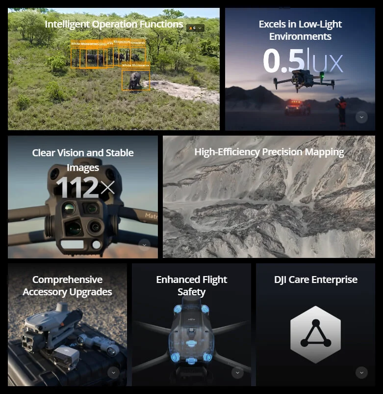
Advanced Night Scene Mode
The Matrice 4T features significantly upgraded night mode with full-color night vision supporting three modes and two levels of enhanced noise reduction. Equipped with IR-Cut Filter and NIR auxiliary light, it effortlessly overcomes darkness challenges, ensuring search and rescue subjects are clearly visible during critical nighttime missions.
Low-Light Fisheye Omnidirectional Sensing
Six high-definition low-light fisheye vision sensors significantly enhance visual low-light positioning and obstacle avoidance capabilities. This enables automatic obstacle avoidance, intelligent rerouting, and safe return-to-home in urban low-light environments, ensuring operational safety during nighttime emergency response.
NIR Illumination for Wildlife and Nighttime Operations
The new NIR illumination hardware enables lighting distances up to 100 meters, ensuring clear visibility of objects in dark environments. This non-visible light source is ideal for wildlife protection, forestry conservation, and covert surveillance applications without disturbing subjects.
Thermal Imaging Excellence
- High-Res Infrared Mode – Image resolutions up to 1280×1024 for detailed thermal analysis
- Ultra-High Resolution Processing – Reveals small temperature details for electrical hotspot detection
- Factory Temperature Calibration – Each device calibrated for accurate temperature measurements
- Real-Time Temperature Monitoring – Onboard sensor provides continuous ambient temperature compensation
- Multiple Color Palettes – Various thermal visualization modes for different inspection scenarios
Intelligent Operation Functions
Smart AI Detection and Tracking
- Built-in AI Detection Model – Automatically detects vehicles, vessels, and subjects during search and rescue or routine patrols
- Expandable Model Library – Supports switching to other AI models for expanded application scenarios
- Thermal Anomaly Detection – Automatically identifies temperature irregularities in infrastructure inspections
- High-Res Grid Photos – Systematic photo organization for comprehensive documentation
- Powerful Smart Track – Intelligent subject following with combined visual and thermal tracking
Efficient Flight Automation
- Cruise Mode – Automated flight path optimization for patrol operations
- FlyTo Function – In emergencies or disasters, automatically adjusts flight path and speed to reach designated locations without manual input
- Smart Track – Autonomous subject tracking for dynamic monitoring of persons or vehicles
- POI (Point of Interest) – Automated circular inspection patterns around infrastructure
Laser Range Finder Applications
- Pin Point Marking – Mark target locations for emergency response coordination
- Line Drawing – Measure distances for perimeter establishment
- Area Calculation – Calculate wildfire areas or disaster zones for resource planning
- QR Code Sharing – Share measurement data via DJI Pilot or FlightHub 2 with incident command
Observation Range Recording
DJI Pilot 2 highlights the center position of camera frame and ground area observed, displaying surveyed areas on the map. This feature is especially useful for search and rescue operations in mountainous terrain without clear landmarks.
Crystal Clear Vision and Stable Imaging
Enhanced Telephoto Performance
- Medium Tele Precision – Detects equipment defects from 10 meters for powerline inspections
- Super Resolution Telephoto – 48MP tele camera captures details from 250 meters for surveillance
- Foreground Stabilization – Upgraded stabilization keeps subjects clear at 10x zoom or higher for public safety operations
- 24/7 Operation – IR-Cut Filter enables optimal imaging in both daylight and nighttime
Electronic Dehazing
In conditions such as smoke, smog, or atmospheric humidity, Electronic Dehazing supports three modes (Low, Medium, High) to improve imaging clarity for firefighting and emergency response operations in challenging visibility conditions.
Enhanced Flight Safety and Reliability
Fusion Positioning with Integrated RTK
The Matrice 4T features integrated DJI RTK module supporting extended L5 frequency band with GNSS+Vision Fusion Positioning and Navigation System. Allows return-to-home point updates through visual positioning for rapid 15-second takeoff. Completes return-to-home even without GNSS signals, effectively overcoming signal obstructions in urban emergency scenarios.
Intelligent Guidance for Safe Operations
- Terrain Elevation Maps – Preload detailed maps when connected to internet for mountainous rescue operations
- Automatic Path Planning – Intelligent obstacle avoidance route generation for night flights
- 5-Directional Vision Assist View – Comprehensive visibility with downward vision system
- Safe Night Operations – Enhanced protection for flights through challenging terrain in darkness
Industry-Leading O4 Enterprise Video Transmission
- 25 km Transmission Range – Extended coverage for remote emergency operations
- 8-Antenna System – Superior signal stability in urban and mountainous environments
- 20MB/s Download Bandwidth – More than double the bitrate of Mavic 3 Enterprise Series for high-quality thermal streaming
- Dual Visual and Thermal Streaming – Simultaneous transmission of visible and infrared video
- DJI Cellular Dongle 2 Support – Optional 4G backup connectivity for mission-critical operations
Comprehensive Accessory Ecosystem
- DJI AL1 Gimbal-Following Spotlight – Illuminates subjects up to 100 meters with Always-On and Strobe modes, connects with gimbal to follow camera movements, adjustable focus for wide or narrow FOV
- Real-Time Voice Speaker – Two-way audio communication for crowd management and emergency instructions
- Integrated Broadcasting and Lighting – Combined audio-visual system for public safety operations
- D-RTK 3 Multifunctional Station – Centimeter-level positioning for multiple drones, relay mode for extended range, Rover Station Mode for high-precision operations
- DJI RC Plus 2 Enterprise – High-brightness remote controller with customizable interface
- DJI Cellular Dongle 2 – 4G connectivity enhancement for reliable communications
- DJI Power 2000 – Extended power solution for prolonged emergency operations
Professional Software Integration
DJI Pilot 2
Comprehensively updated interface with customizable intelligent function toolbar supporting various flight route types for patrol and inspection missions. Features virtual space models and route preview functions. Connects with FlightHub 2 for enhanced drone control operations and cloud information sharing, reducing frontline pilot workload during emergencies.
DJI FlightHub 2
Cloud-based fleet management platform for coordinating multiple drones during large-scale emergency response. Real-time monitoring, data sharing, and collaborative workflows for incident command integration.
Additional Software Tools
- DJI Modify – Mission planning and route customization for inspection operations
- DTAT 3.0 – Data processing and thermal analysis tools
Open Developer Ecosystem
Developer Platform Support
- PSDK (Payload SDK) – E-Port and E-Port Lite encryption authentication for secure third-party payloads like additional sensors or delivery systems
- MSDK (Mobile SDK 5) – Fully open-source with production code samples for custom emergency response applications
- Cloud API – MQTT-based protocol for direct integration with public safety command centers
- Intelligent Algorithm Developer Support – Model training tools and certification for expanding detection capabilities
Data Security and Operational Privacy
- Local Data Mode – Keep sensitive mission data on device without cloud upload for classified operations
- One-Tap Clear All Device Data – Instant data wipe for security compliance
- AES-256 Video Transmission Encryption – Military-grade encryption for secure communications
- Cloud API Security – Secure integration with government and enterprise platforms
Application Scenarios
- Public Safety and Law Enforcement – Search and rescue, suspect tracking, crowd monitoring, and perimeter security
- Emergency Response – Disaster assessment, missing person detection, evacuation coordination, and real-time situational awareness
- Firefighting Operations – Hot spot detection, fire perimeter mapping, personnel safety monitoring, and structure thermal analysis
- Powerline and Electrical Infrastructure – Thermal anomaly detection on transmission lines, transformer inspections, and substation monitoring
- Forestry Conservation – Wildlife monitoring with NIR illumination, forest fire detection, and illegal logging surveillance
- Oil and Gas – Pipeline leak detection with thermal imaging, flare stack monitoring, and facility inspections
- Renewable Energy – Solar panel hot spot detection and wind turbine thermal inspections
- Maritime Operations – Vessel detection, man overboard search with thermal imaging, and coastal patrol