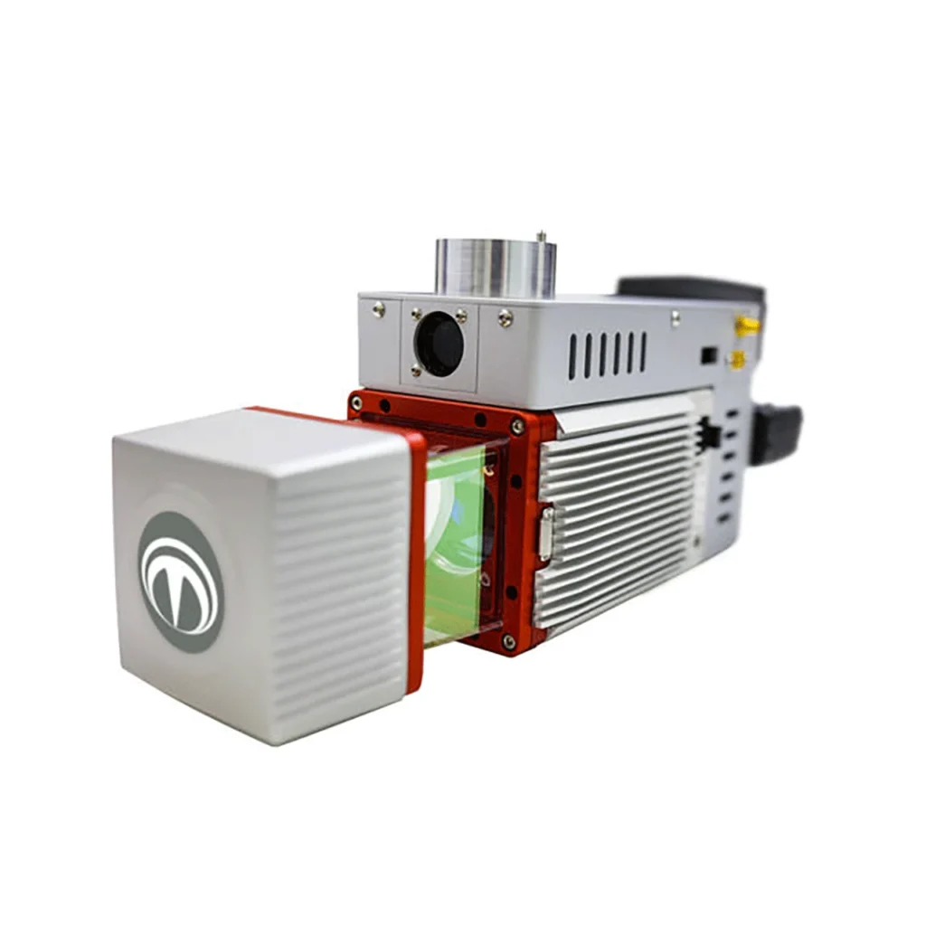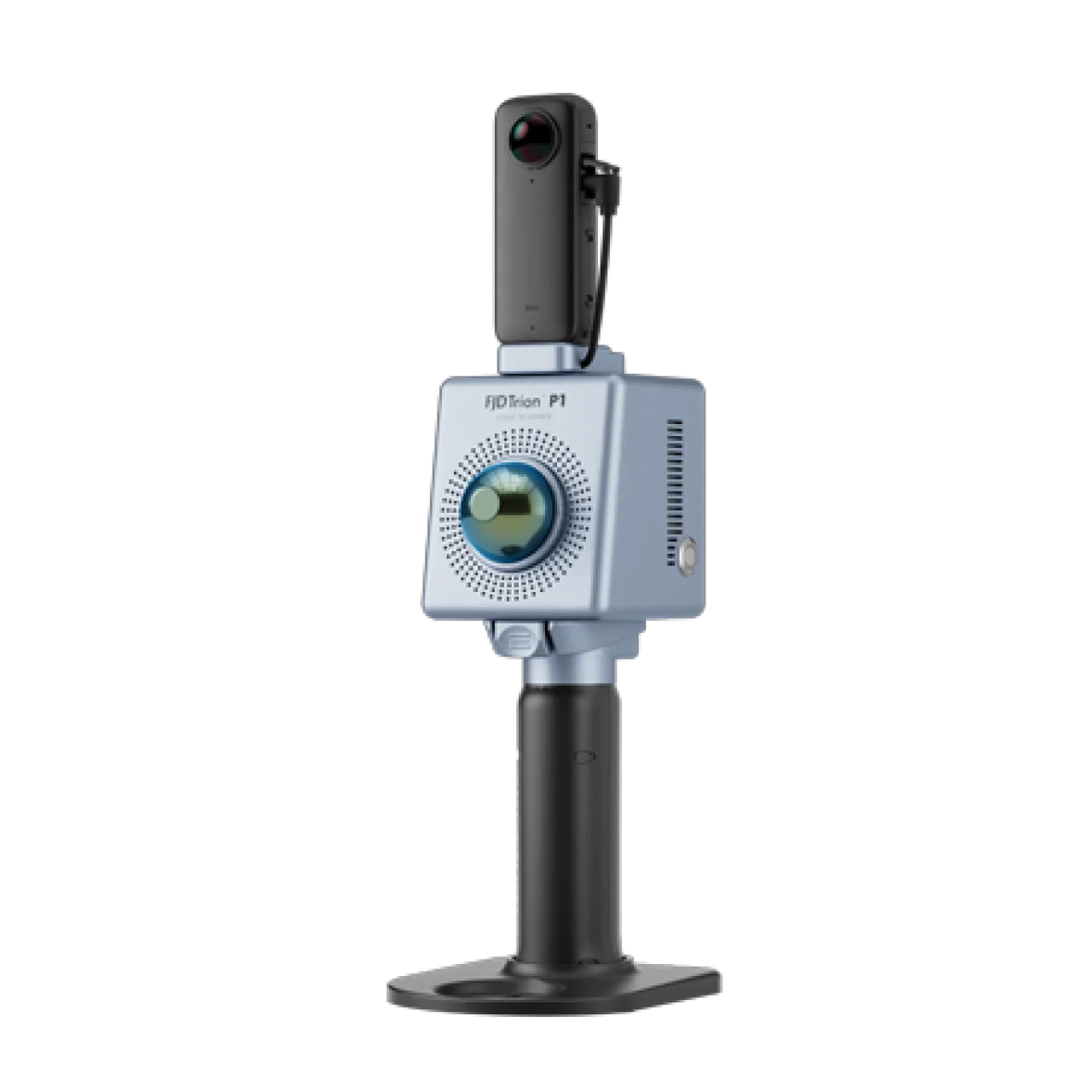
Portable Handheld LiDAR Scanner for 3D Reality Capture

The FJD Trion P1 is a lightweight, handheld LiDAR scanner that makes 3D reality capture accessible to everyone — from seasoned laser scanning professionals to those exploring 3D digitization for the first time. Simply walk around any site to digitize your environment quickly and accurately, producing survey-grade point cloud data ready for BIM, CAD, and geospatial deliverables.
Whether you’re mapping building interiors, documenting construction progress, surveying underground utilities, or analyzing forest inventory — the FJD Trion P1 captures what you see with intricate detail. Powered by advanced SLAM (Simultaneous Localization and Mapping) technology, the P1 works reliably in direct sunlight, complete darkness, and GNSS-denied environments where traditional survey methods fall short.
Available from Terra Drone Arabia, the authorized FJD dealer in Saudi Arabia, with local warranty, professional training, and technical support across KSA and the Middle East.
Key Features
Easy Reality Capture
Whether you are a seasoned laser scanning professional or just 3D-curious, a walk around the site with the FJD Trion P1 lets you digitize your environment quickly and accurately. No tripod setup, no scan station planning — just pick up and scan.
Indoor, Outdoor, Underground — All Day Long
Wherever you go, the P1 captures what you see. Map environments with intricate detail inside and outside — from ornate architecture to hidden infrastructure, from forensic evidence to urban vegetation analysis. Powerful SLAM technology enables the P1 to work in direct sunlight, complete darkness, and GNSS-denied locations that are inaccessible with traditional survey methods.
Compact Yet Mighty
Weighing only 1 kg, the FJD Trion P1 fits in a messenger bag and can operate all day with easy battery swaps. Recreate your environment in minutes — what used to take hours with a terrestrial scanner now takes a single walk-through.
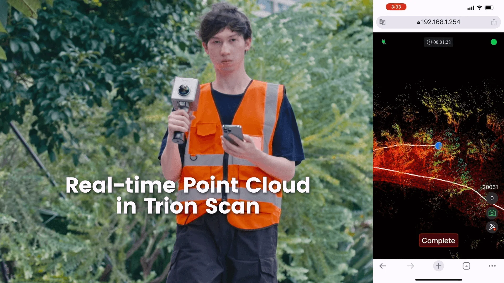
Real-Time Point Cloud Preview
View live point cloud data on your mobile device via the FJD Trion Scan app during capture. Check for data completeness and monitor loop closure numbers on-site to ensure enough data is captured for proper post-processing — no surprises back in the office.
Multiple Configurations
Integrate the P1 into your workflow to maximize efficiency in data capture:
- Panoramic Camera: Capture RGB videos for colorized point clouds and visual documentation.
- RTK Module: Generate georeferenced point cloud data with centimeter-level absolute positioning.
- Extension Pole: Map elevated spaces and hard-to-reach areas without ladders or scaffolding.
Scan-to-Deliverable Workflow
1. Capture
Walk and scan with the P1 while viewing real-time point cloud data on your mobile device via FJD Trion Scan. Check for data completeness and note loop closure numbers to ensure enough data is captured for proper post-processing.
2. Analyze
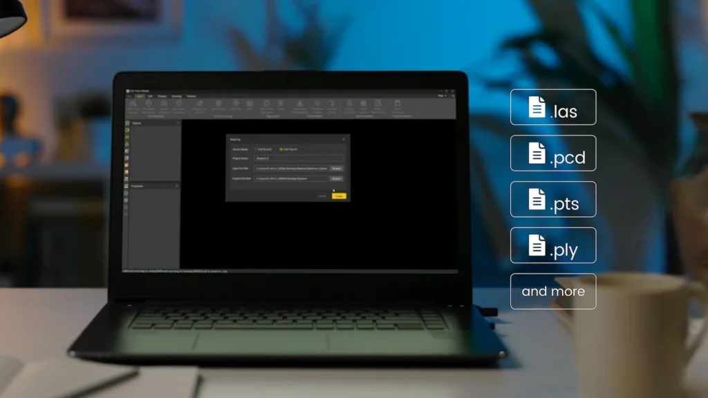
The P1 produces universal point cloud data formats (LAS, PCD, PTS, PLY). Download and import field data into FJD Trion Model or compatible third-party software to classify, register, and calculate point cloud data for your specific application. Scan to post-processing time ratio is approximately 3:1.
3. Deliver
Generate professional deliverables including contour maps, distance/area/volume calculations, floor plans, tree and forest analyses, and 3D models such as BIM, DEM, and 3D mesh.
4. Grow
Save time and labor on fieldwork. Eliminate rework and errors that come with manual measurements. Keep your teams focused on the most valuable tasks, and offer new services and deliverables to your clients to grow your business.
FJD Trion Software Ecosystem
Seamless integration from point cloud capture, data processing, to deliverable sharing — giving you a smooth project experience from field to office.
| Software | Function |
|---|---|
| FJD Trion Scan | Real-time app control and scan file management during data collection. |
| FJD Trion Model | Desktop data processing — generate construction, forestry, mining reports, and more. |
| FJD Trion Model for Tablets | iPad and Android support for on-site post-processing, preview, and deliverable generation. |
| FJD Trion Explorer | Share point cloud data online and support collaboration across teams and stakeholders. |
Application Scenarios
Architecture, Engineering & Construction (AEC)
Make more informed decisions on your projects from blueprint to QA/QC with building surveys, scan-to-CAD/BIM, as-built documentation, floor plans, and stockpile volume calculations.
Property Management & Assessment
Assess structural integrity, plan spaces, and identify areas in need of repair or renovation. Reduce uncertainty in investment decisions with insights from a rich spatial dataset.
Facility Management & Indoor Mapping
Digitize complex indoor environments including industrial plants, warehouses, data centers, and commercial buildings for space planning, asset management, and retrofit design.
Public Safety & Forensics
Leverage point cloud data to enhance disaster preparedness and recovery plans. Quickly record evidence and crime or accident scenes for immediate and accurate forensic documentation.
Forestry & Vegetation Analysis
Manage and monitor tree inventory with a quick walk in the forest. Measure crowns, analyze breast diameter and tree height using precise point cloud data.
Media & Entertainment
Craft new realities based on real-world inspirations. Whether you’re creating video games, virtual tours, or cinematic environments, capture the essence of both indoor and outdoor settings.
FJD Trion P1 vs S2: Which Scanner Is Right for You?
| Feature | FJD Trion P1 (Handheld) | FJD Trion S2 (Terrestrial) |
|---|---|---|
| Type | Handheld / Walk-through | Terrestrial / Tripod-mounted |
| Best For | Indoor mapping, quick site capture, BIM documentation | High-precision facility scanning, as-built surveys, large-scale projects |
| Scan Speed | Walk-through — capture entire building in minutes | Station-based — multiple setups required |
| Accuracy | Up to 2 cm relative | Sub-millimeter accuracy |
| Portability | 1 kg — fits in messenger bag | Requires tripod and transport case |
| Ideal Client | Rapid site documentation, facility managers, AEC firms needing speed | Engineering firms needing sub-mm accuracy for complex industrial plants |
Need the highest accuracy for industrial plants? Consider the FJD Trion S2 LiDAR Scanner.
Need both? Contact us for a bundled solution with local training and support.
Why Buy from Terra Drone Arabia?
- Authorized FJD Dealer: Official FJD Dynamics dealer in Saudi Arabia — genuine products with local manufacturer warranty.
- Local Technical Support: On-ground support teams in Riyadh and Dhahran for setup, calibration, and troubleshooting across KSA.
- Professional Training: Hands-on training on the FJD Trion P1, Trion Scan app, and Trion Model software to maximize your ROI.
- Free Consultation: Expert advice on integrating LiDAR into your AEC, forestry, or facility management workflows.
- Shipping Across KSA: Fast delivery to Riyadh, Jeddah, Dammam, Dhahran, and NEOM with local support.
Get a Quote for FJD Trion P1
Ready to digitize your environment with the FJD Trion P1 handheld LiDAR scanner? Contact Terra Drone Arabia for pricing, availability, and a free consultation. Whatsapp Us