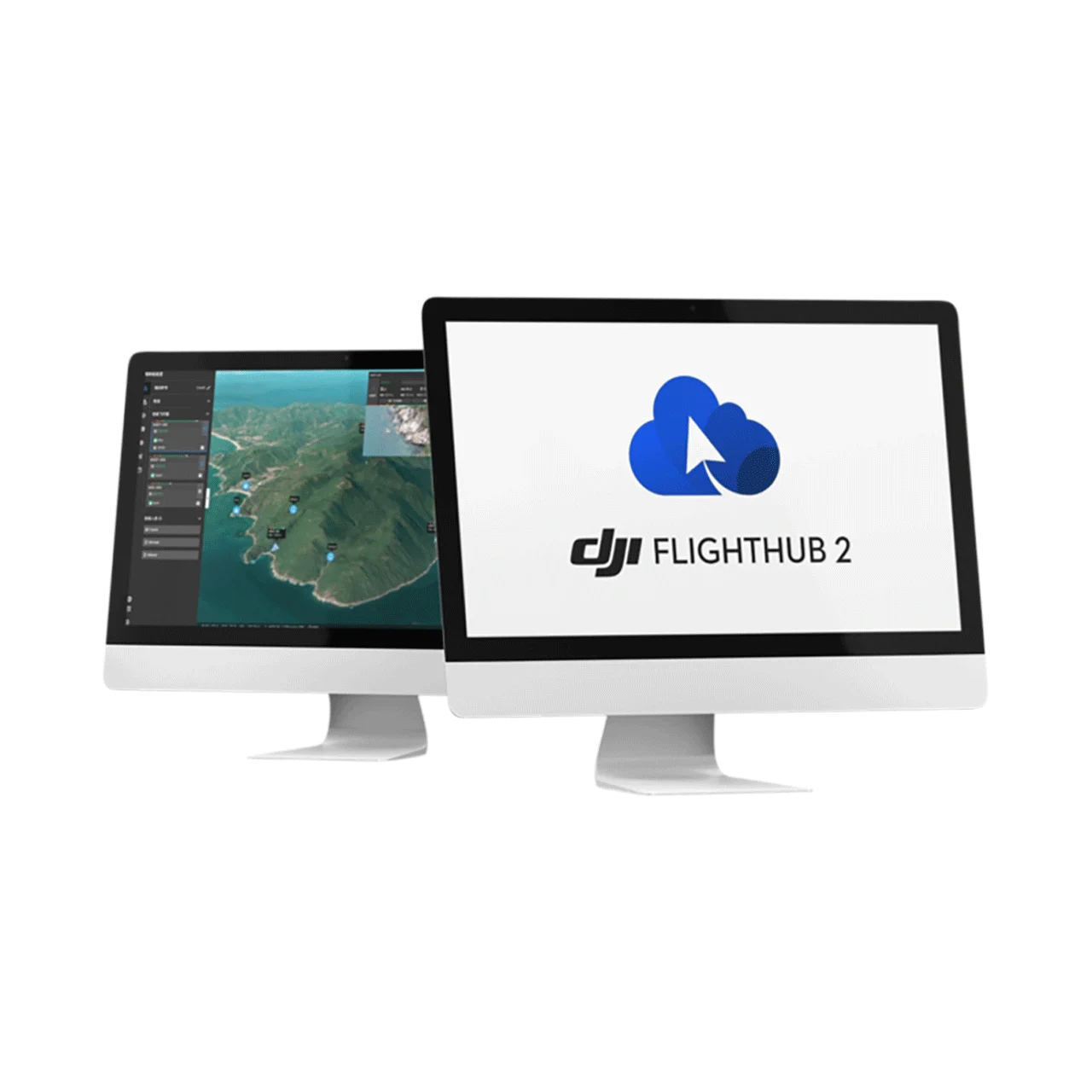
DJI FlightHub 2 Enterprise Version is a one-stop cloud-based drone operations management platform powered by intelligent algorithms and a Multimodal Large Language Model (LLM). It delivers real-time remote control, comprehensive flight planning, AI-powered precision inspection, end-to-end data analysis, and fully automated workflows — with unlimited storage, unlimited accounts, unlimited livestream duration, and third-party integration via OpenAPI and FlightHub Sync. Engineered for public safety, emergency response, geospatial mapping, and infrastructure inspection, it provides complete air-ground integrated operations with ISO/IEC 27001 and ISO 27701 certified data security.
Enterprise Version – What’s Included
- Livestream: Unlimited duration (30,000–100,000 minutes/year for dock cameras depending on plan)
- Storage Capacity: Unlimited
- Mapping Quantity: 150,000 images (1-Year, 1 Device) / 500,000 images (3-Year, 1 Device)
- Max Online Device Quantity: Determined by purchased package
- Account Quantity: Unlimited
- Features: Dashboard, Analyzer, Auto Dispatch Workflow, Custom Project Roles & Permissions, Smart Search for Media Files (unlimited), Change Detection (unlimited), 3rd-Party Algorithm Integration, Flight Records, Data Sharing Within Org, Replace Logo, 3rd-Party Account Login, OpenAPI, FlightHub Sync
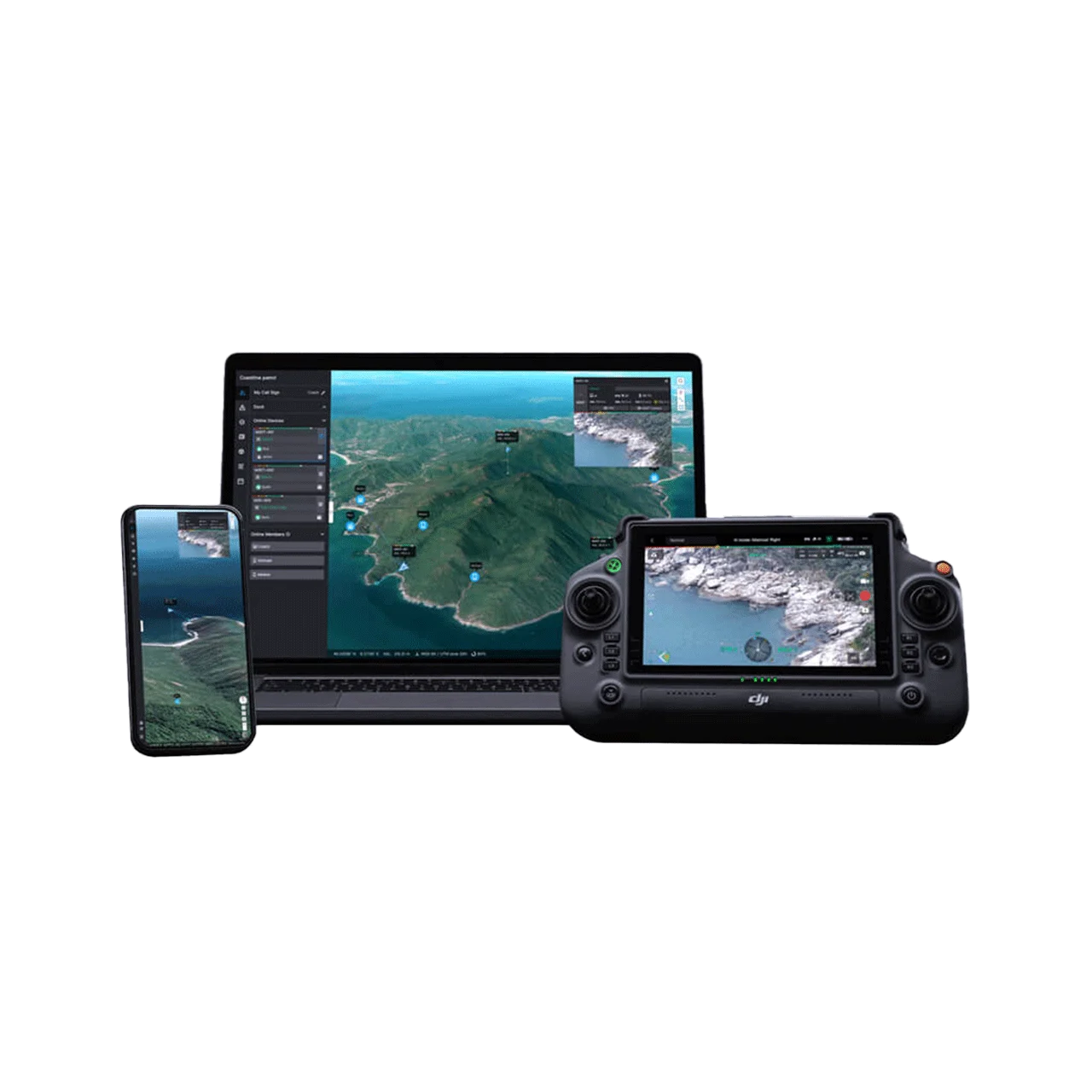
Real-Time Remote Operation – Virtual Cockpit

Remote Control & Multi-Drone Management
- Remote Control via Mouse & Keyboard – Mouselook mode and drag-select zoom for efficient camera control
- Multi-Drone Control – Synchronized control of multiple drones with automatic task swapping and one-click Return-to-Home
- FlyTo Tasks – One-click destination setting; FlightHub 2 automatically plans the optimal flight route for rapid emergency response
- Smart Track – Continuous detection, counting, and tracking of vehicles, boats, and objects with automatic alerts
- AR Street View – Real-time overlay of buildings and street data on live video for enhanced situational awareness
Ground-to-Cloud Synergy
- Dashboard – Real-time visibility into device status, task progress, and flight statistics
- Live Annotations – Mark objects, plan routes, and assign task areas across multiple devices with real-time synchronization
- Simultaneous Livestreams – Multiple drone livestreams with flexible layout for real-time situational awareness
- Livestream Sharing – Generate custom links or mobile QR codes for instant team collaboration
Comprehensive Flight Planning
Patrol & Inspection Routes
- Waypoint Routes – 3D model-based immersive WYSIWYG route editing with intelligent point-by-point detection actions
- Patrol Routes – Auto-planned patrol routes based on specified regions; drones automatically detect, record, and alert
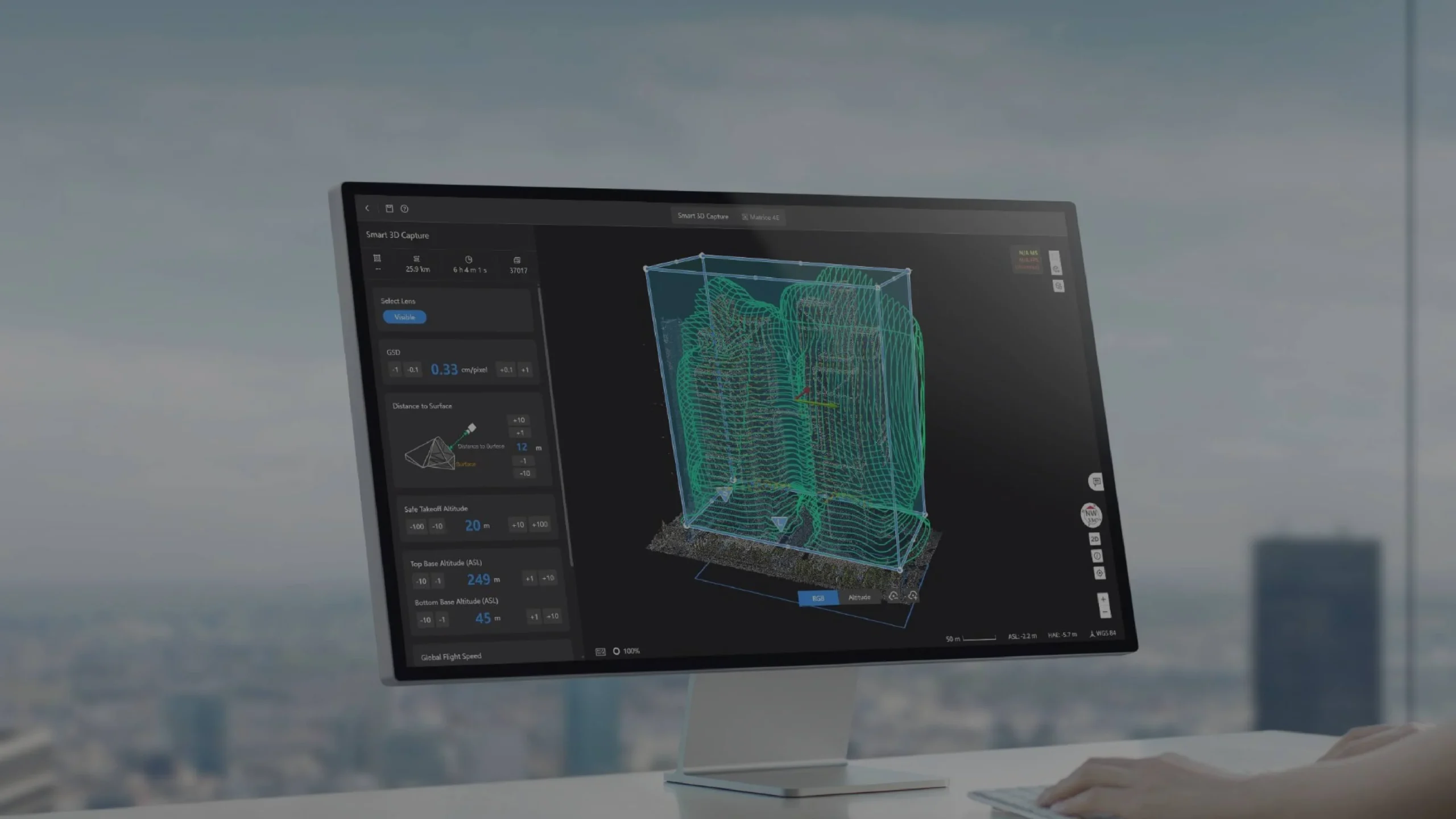
Mapping Routes
- Area Routes – Large-scale 2D/3D mapping with advanced overlap settings and Custom GEO Zone bypassing
- Linear Routes – Optimized for rivers, pipelines, and roads with intelligent long-distance mission segmentation
- Smart 3D Capture – Generates refined capture routes along complex object surfaces from rough models
- Slope & Geometric Routes – Model-based routes for bridges, slopes, and individual buildings with auto-sync to remote controller
Intelligent Algorithms & Multimodal LLM

Smart Detection & Automatic Alerts
- Smart Detection – Built-in algorithms for automatic vehicle and boat detection and counting; supports third-party algorithm integration
- Automatic Alerts – Pop-up and sound alerts with full records of object type, location, timestamp, and imagery
- Smart Patrol – Combine object detection with waypoint or patrol routes for fully automated security and inspection operations
Multimodal Large Language Model (LLM)
- Multimodal Object Detection – Search for any object via text or image input; LLM interprets requirements and triggers alerts for complete situational awareness
- Multimodal Media Search – Query objects across extensive drone imagery and video via text or image, with rapid operational report generation
- Algorithms on Drone & Cloud – Seamlessly switch between onboard (Manifold 3) and cloud-based third-party algorithms via Algorithm Management
End-to-End Data Analysis
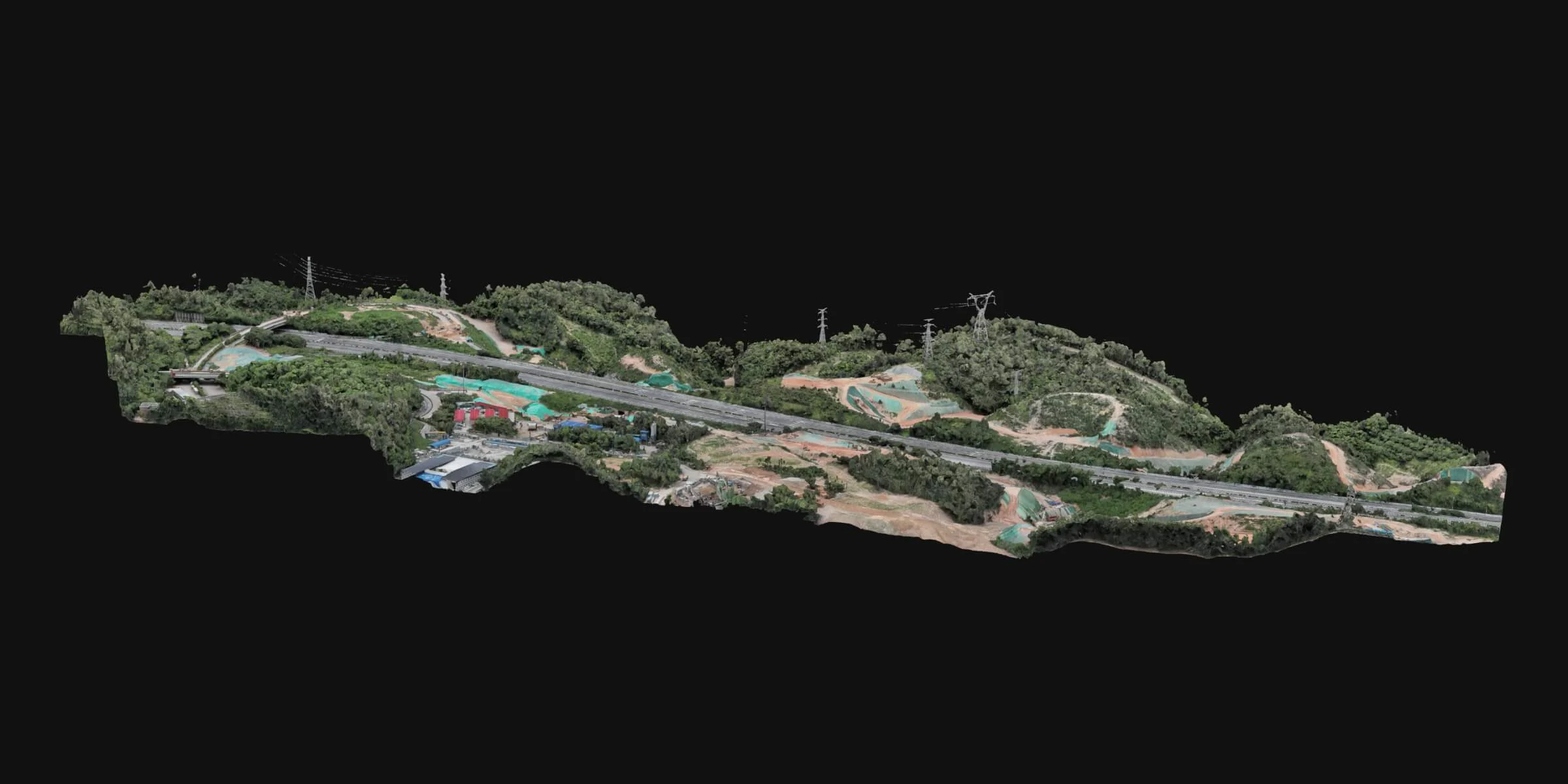
Cloud Modeling
Efficient cloud-based 2D and 3D reality model and point cloud reconstruction meeting 1:500 scale mapping accuracy. Supports real-time 2D model reconstruction during flight with export in multiple industry-standard formats.
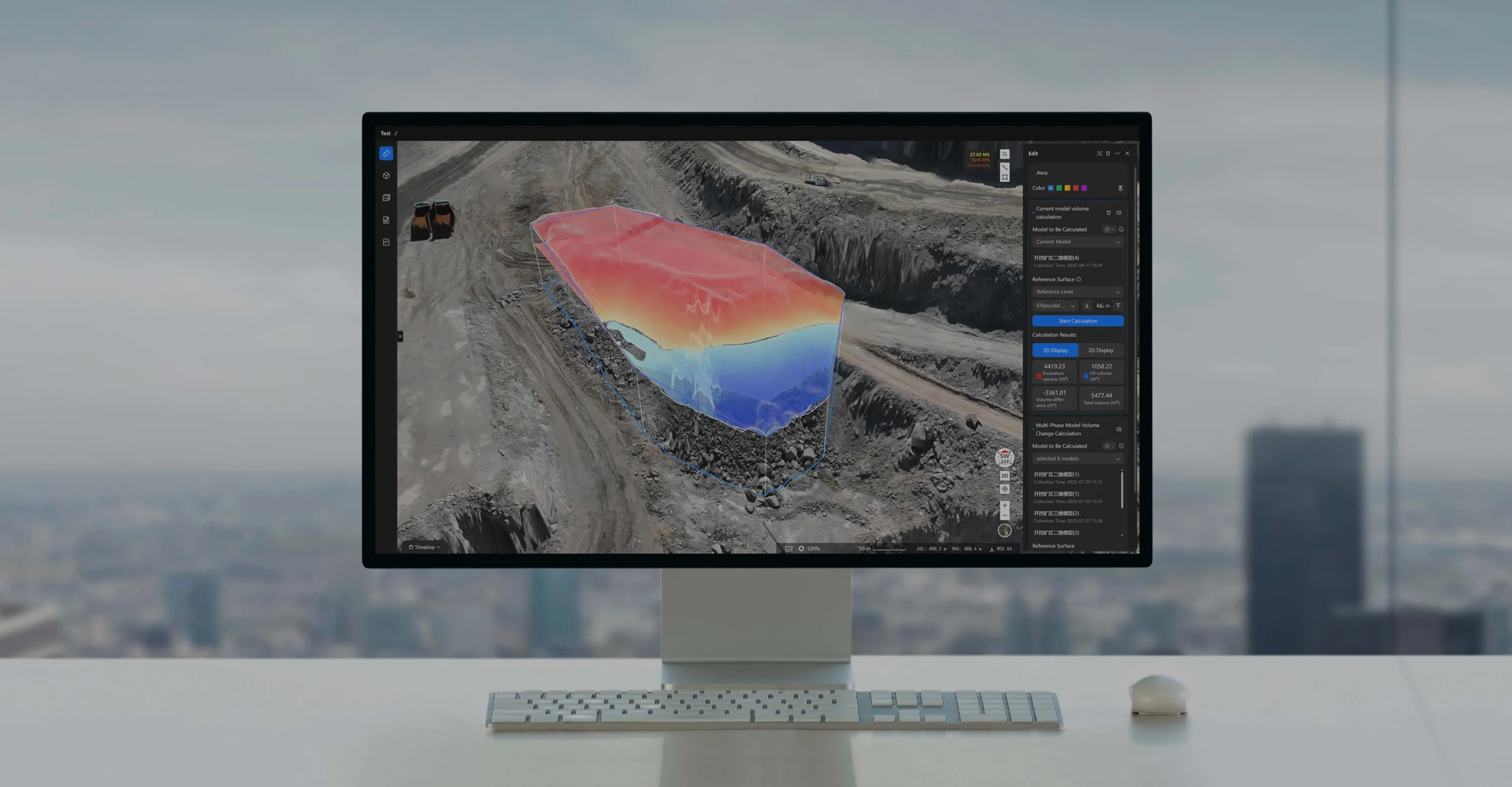
Analyzer
- Design File Import – PDF and DXF import with coordinate transformation tools to overlay designs on reality models
- Timeline – Temporal analysis of time-series imagery alongside 2D/3D models to track site changes over time
- Measurement & Calculation – Distance, altitude, area, and volume measurement with one-click data extraction
- Measurement Reports – Automatically generated and shared for project progress tracking and quality control
- Change Detection – Unlimited intelligent change detection between media files or orthomosaics with automatic report generation
- Result Comparison – Side-by-side manual comparison of media files or orthomosaics with synchronized map annotations
Seamless Automated Workflows
- Automated Triggered Workflow – Chains Trigger, FlyTo Task, and Aircraft Action nodes for automatic or manual drone dispatch upon alerts — ideal for law enforcement, emergency response, and patrol
- Automated Periodic Workflow – Drag-and-drop configuration integrating collection, reconstruction, analysis, and reporting in a fully automated end-to-end cycle
Operational Safety & Compliance
- Custom GEO Zone – Configure task areas, no-landing zones, and obstacle data for guaranteed flight safety
- Custom Project Roles & Permissions – Flexible role management for enterprise team operations
- SSO & Multi-Factor Authentication (MFA) – Secure login to prevent unauthorized access
- ADS-B Integration – Real-time airspace conflict alerts from surrounding manned aircraft
- Localized Compliance – Supports geofencing, redundant control links, and remote ID broadcast per regional regulations
Secure & Flexible Integration
- OpenAPI (RESTful) – Access core platform capabilities and 2D/3D reconstruction via API for custom system integration
- FlightHub Sync – Code-free integration via visual interface; sync flight routes, media files, models, and live streams (RTMP, RTSP, GB28181)
- 3rd-Party Account Login – Enterprise SSO unified authentication support
- Data Sharing Within Org – Seamless internal data sharing across teams and projects
Data Security & Certifications
- ISO/IEC 27001 Certified – Information security management system compliance
- ISO 27701 Certified – Privacy management compliance
- AWS Cloud Storage – Data for non-Chinese users stored on Amazon Web Services (US and Europe)
- On-Premises Option Available – Deploy in a fully isolated intranet for maximum data sovereignty
Supported Devices
- DJI Dock 2 & Dock 3 – Automated drone-in-a-box operations
- DJI Matrice 400 – Enterprise flagship drone platform
- DJI Matrice 4 Series – Latest enterprise multi-sensor platforms
- DJI Mavic 3 Enterprise Series – Compact enterprise solutions