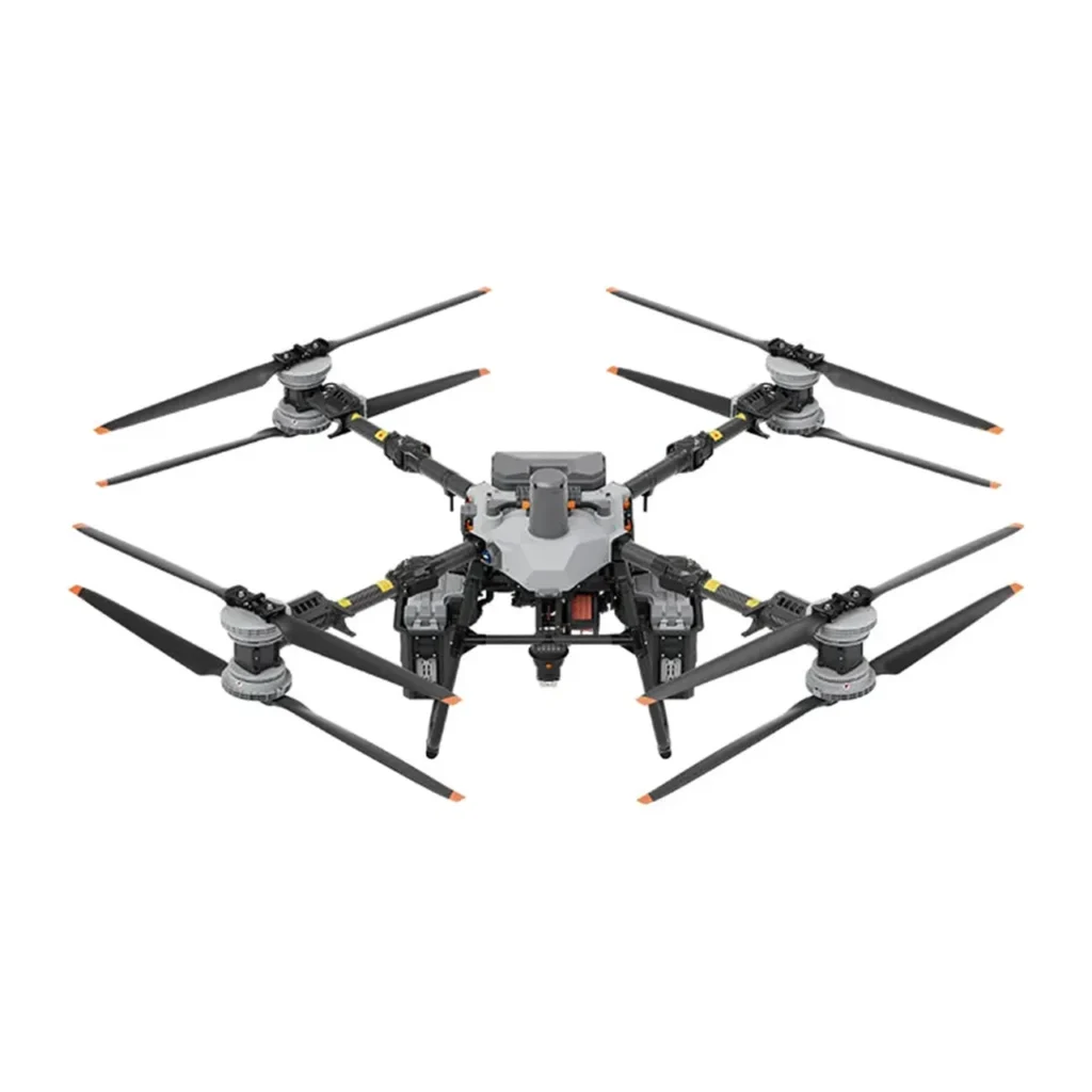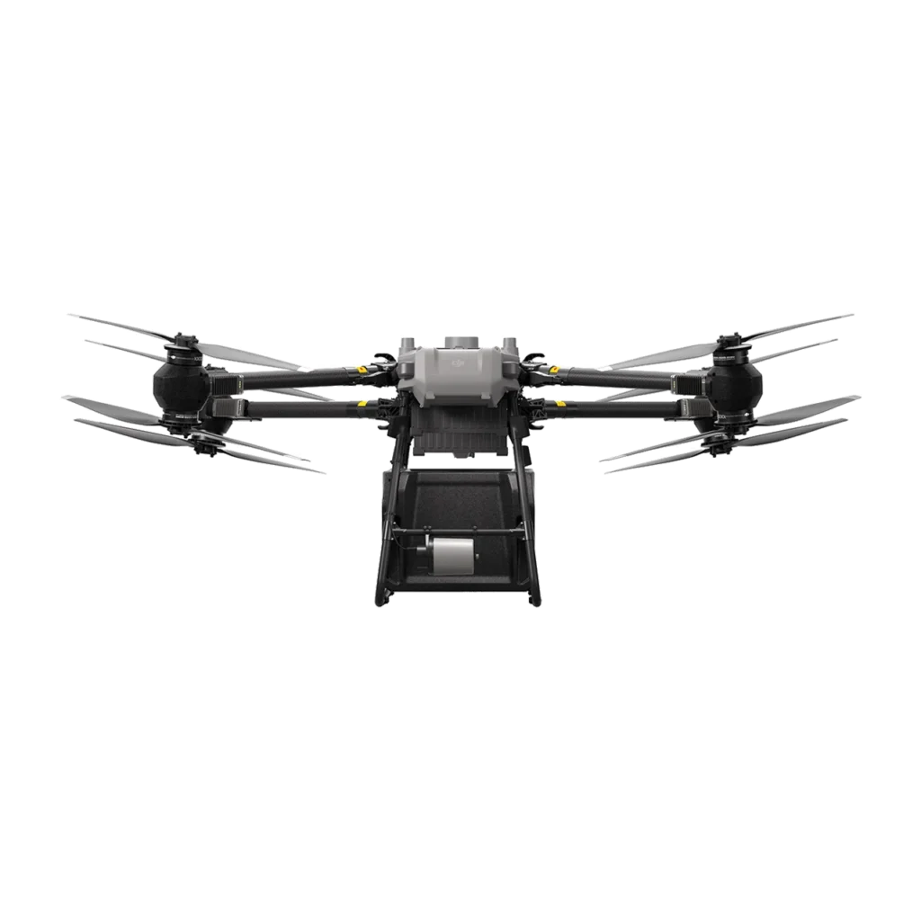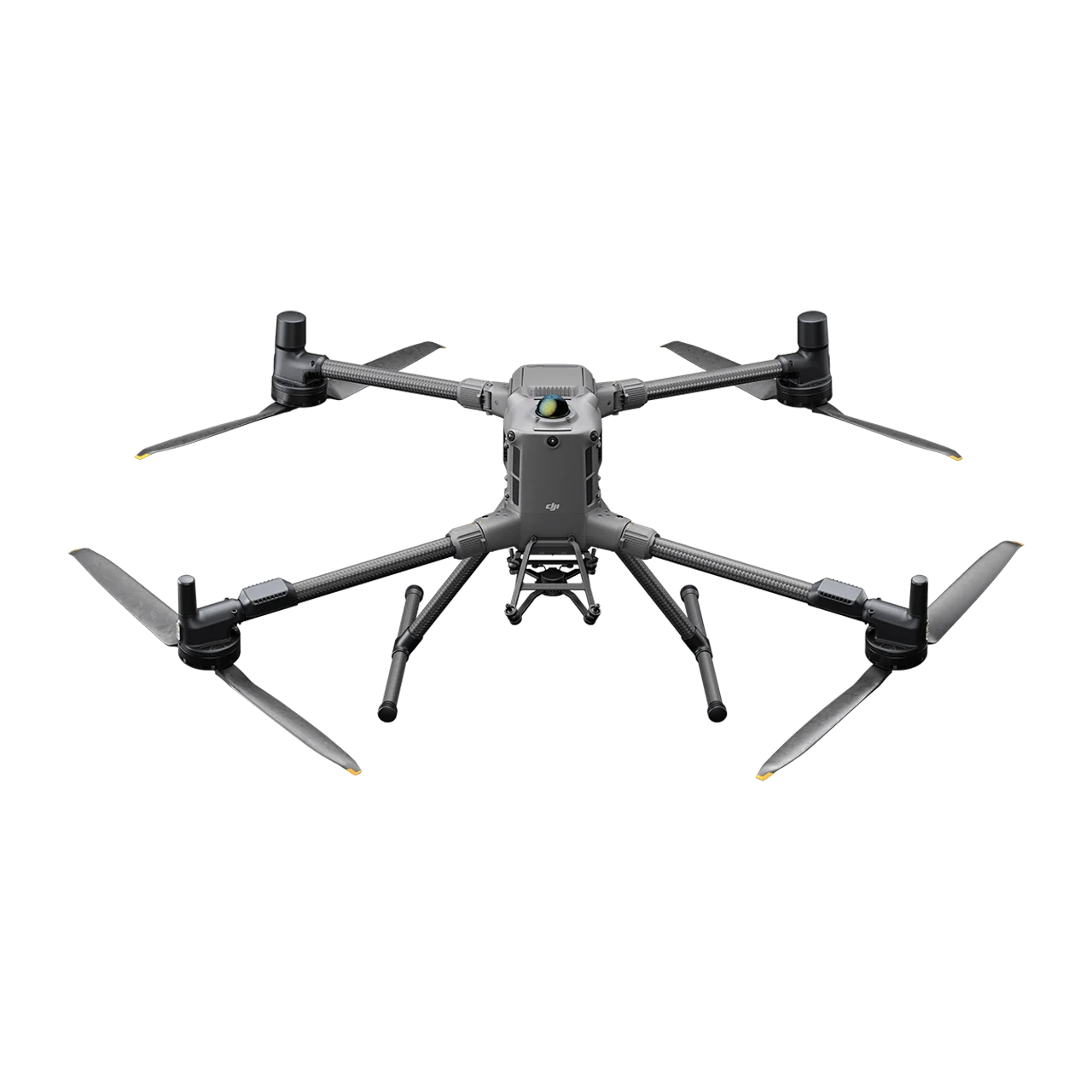
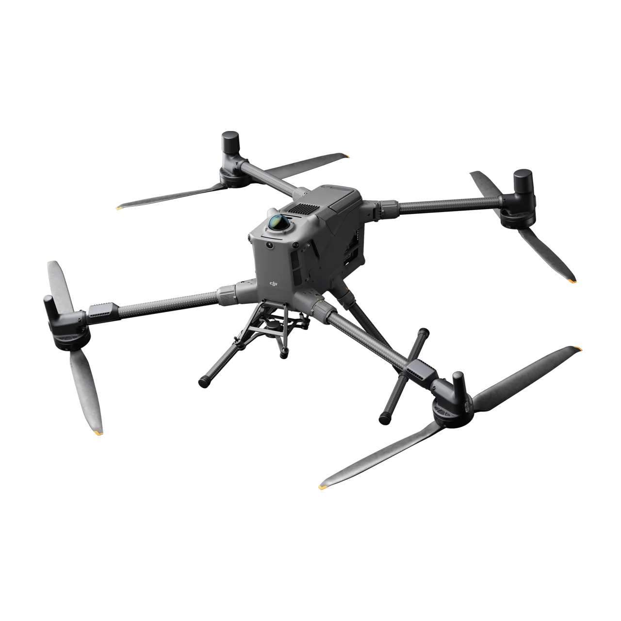
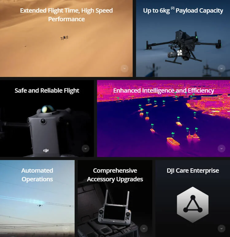
DJI Matrice 400 is the enterprise flagship long-endurance drone platform engineered for excellence and designed for versatility across the most demanding industrial missions. Boasting an impressive 59-minute forward flight time, 6 kg maximum payload capacity, and power-line-level obstacle sensing powered by integrated rotating LiDAR and mmWave radar, the Matrice 400 sets new standards for enterprise aerial operations. Supporting O4 Enterprise Enhanced Video Transmission up to 40 km, Airborne Relay Video Transmission, and ship-based takeoff and landing, this platform combines Smart Detection with visible and thermal imaging, AR projection, and advanced automation to excel in emergency response, power inspections, precision mapping, and AEC applications. With up to 7 simultaneous payloads, 4 external E-Port V2 ports, and compatibility with the full Zenmuse ecosystem, the Matrice 400 delivers unmatched versatility for complex multi-scenario operations.
Extended Flight Time and High-Speed Performance
Industry-Leading Flight Endurance
- 59 Minutes Forward Flight Time – Even with payload, ideal for long-duration search and rescue, firefighting, and large-scale mapping
- 53 Minutes Hovering Duration – Extended stationary operations for inspections and surveillance
- 49 km Maximum Flight Distance – Extended range for large-area coverage
- 25 m/s Maximum Flight Speed – Rapid transit capability while avoiding large obstacles like buildings and mountains
- 7,000 m Maximum Altitude – High-altitude operational capability
- 12 m/s Wind Resistance – Stable performance in challenging weather conditions
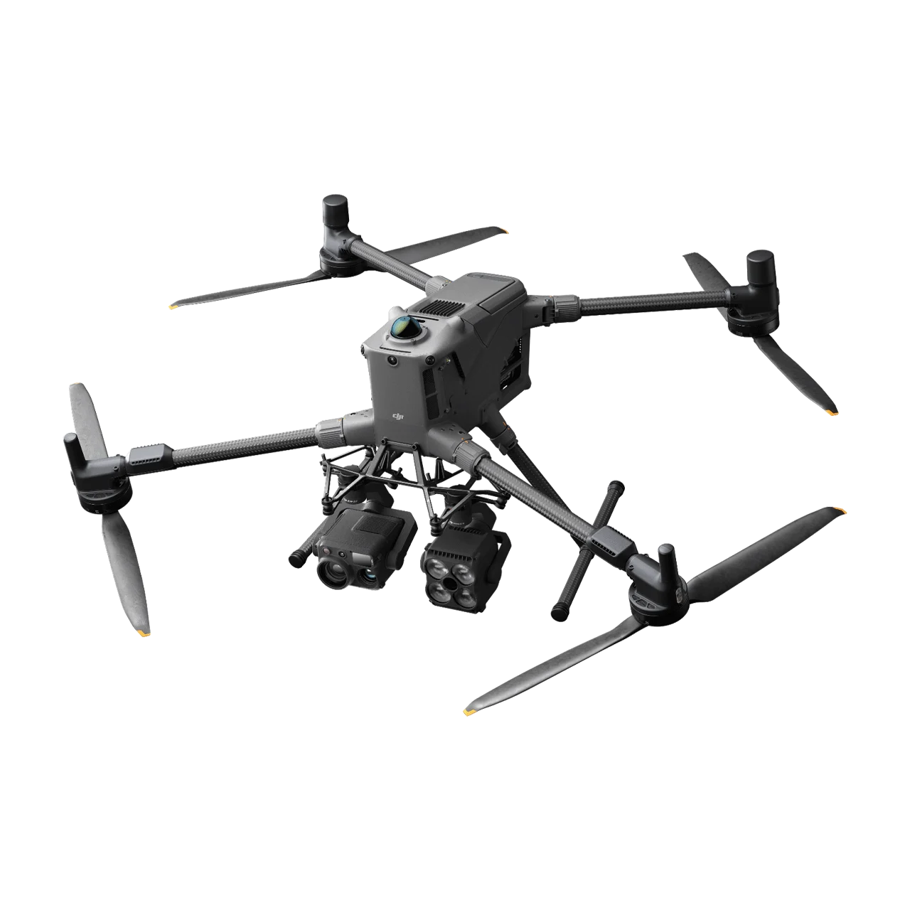
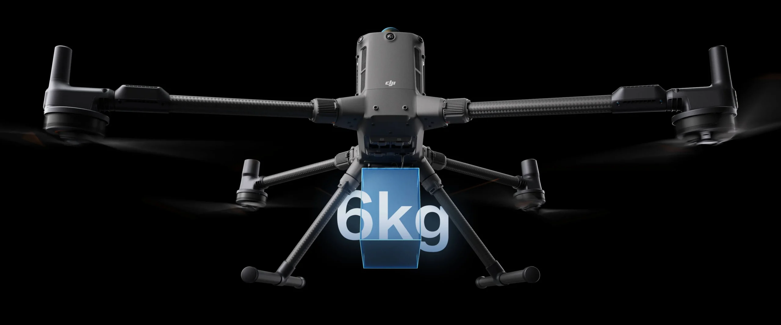
Up to 6 kg Payload Capacity – Multi-Payload, Multi-Scene
Versatile Payload Configuration
- 6 kg Maximum Payload Capacity – Supports a wide range of professional applications
- Single and Dual Downward Gimbal Support – Seamless switching between configurations
- Third Gimbal Connector – Additional mounting point for up to 6 kg (screw lock) or 3 kg (quick-release)
- 4 External E-Port V2 Ports – USB 3.0 high-speed communication delivering up to 120W per port
- Up to 7 Simultaneous Payloads – E-Port Hub expansion enables maximum multi-sensor operations
Compatible Zenmuse Payload Ecosystem
- Zenmuse H30 Series – Integrates wide-angle camera, zoom camera, infrared thermal camera, laser range finder, and NIR auxiliary light for 24/7 intelligent operations
- Zenmuse L3 – Features 1535nm long-range LiDAR, dual 100MP RGB mapping cameras, and high-precision POS for accelerated geospatial data acquisition
- Zenmuse P1 – Full-frame sensor with interchangeable fixed-focus lenses on 3-axis stabilized gimbal for photogrammetry excellence
- Zenmuse S1 Spotlight – LEP technology spotlight with high brightness and multiple lighting modes for nighttime public safety and inspection operations
- Zenmuse V1 Speaker – High-volume loudspeaker with long broadcast distance and multiple modes for public safety and emergency rescue
- Manifold 3 – 100 TOPS onboard computing power in a 120g compact unit for intelligent processing applications
- Third-Party Payloads – Open ecosystem supports custom payload integration
Safe and Reliable Flight – Built for Challenging Conditions
All-Weather Protection
- IP55 Protection Rating – Reliable operation in heavy dust and rain environments
- -20° to 50°C Operating Temperature – Consistent performance in extreme hot and cold conditions
- Corrosion-Resistant Construction – Durable design for marine and industrial environments
Power-Line-Level Obstacle Sensing
The DJI Matrice 400 features an advanced obstacle sensing system integrating rotating LiDAR (360° horizontal, 58° vertical, 520,000 pts/s), high-precision 6-directional mmWave radar, and full-color low-light fisheye vision sensors. This system detects even small obstacles like high-voltage power lines across mountainous terrain in complete darkness, and can penetrate rain and fog for enhanced safety in challenging weather conditions.
- Rotating LiDAR – 360° horizontal coverage, 520,000 points/second for comprehensive environmental mapping
- 6-Directional mmWave Radar – Penetrates rain and fog for all-weather obstacle sensing
- Full-Color Low-Light Fisheye Vision Sensors – Four sensors provide Full-Color Vision Assist for safer flight
- Detection Range – 0.3-200m depending on sensor and direction
Aircraft Fusion Positioning
The combined omnidirectional sensing from rotating LiDAR, mmWave radar, and fisheye vision provides the Matrice 400 with exceptional positioning stability. It can fly close to glass-facade buildings or wind turbine blades and safely return from building edges, mountain bases, or bridge sides even without return point updates.
Robust Video Transmission System
- 40 km O4 Enterprise Enhanced Video Transmission – Ten-antenna aircraft system with high-gain phased array remote controller antenna
- Sub-2G Frequency Band Support – Enhanced penetration in obstructed environments
- Dual DJI Cellular Dongle 2 Support – Automatically switches to better carrier network for stable signal in urban or remote areas
- 3-Channel 1080p/30fps Live View – Simultaneous multi-feed monitoring
- 80 Mbps Download Bandwidth – Fast data transfer for high-resolution content
Airborne Relay Video Transmission
The Matrice 400 features a built-in video transmission relay module. One Matrice 400 flies high as a relay drone while another operates at extended distances. This significantly extends transmission range, making it ideal for search and rescue and inspections in mountainous areas.
Enhanced Intelligence and Efficiency
Smart Detection with AI
- Vehicle and Vessel Detection – AI-powered identification during search and rescue or routine flights using Zenmuse H30 Series visible and thermal imaging
- Expandable AI Models – Switch between detection models to expand application scenarios
- High-Res Grid Photos – Systematic documentation for comprehensive coverage
- Smart Track – Powerful autonomous subject tracking capabilities
Smart AR Projection
- Power Line AR – Visualizes power line locations during inspection missions
- Map View AR – Overlays map information on live video feed
- AR Flight Waypoint – Visual waypoint guidance for precise navigation
- Live Annotations – Real-time building and landmark name display with key road marking in urban regions day and night
Real-Time Terrain Follow
The Matrice 400 supports real-time terrain follow flight in any horizontal direction, available during both manual and automated flight routes. This maintains stable relative height above ground, keeps subject sizes consistent during search and rescue for reduced zoom adjustments, and maintains consistent ground sampling distance (GSD) for high-precision mapping data.
Takeoff and Landing on Ships
Specifically designed for offshore operations including maritime patrol and wind turbine inspections, the Matrice 400 supports takeoff from stationary vessels and precision landing on moving vessels by detecting landing point patterns on the deck for safe and accurate touchdowns.
Intelligent Flight Modes
- Cruise – Automated sustained flight for efficient long-distance operations
- FlyTo – Automatically adjusts flight path and speed to reach designated locations without manual input
- Smart Track – Intelligent autonomous subject following for dynamic monitoring
- POI (Point of Interest) – Automated circular inspection patterns around infrastructure
Automated Operations – Easier and More Efficient
Advanced Route Planning
- Power Line Follow – Automated tracking of power line corridors with Zenmuse L3/L2
- Slope Routes – Detailed aerial surveys of building facades, slopes, and inclined surfaces
- Geometric Routes – Precise data collection for individual buildings and structures
- Cloud-Based Route Planning – DJI FlightHub 2 enables remote route configuration and synchronization
DJI FlightHub 2 Integration
Specifically upgraded for the Matrice 400, FlightHub 2 enables cloud-based remote control of flight attitude, official payloads, remote takeoff, landing, and Live Flight Controls. During multi-drone operations, operators can remotely synchronize and display multiple livestreams across screens for efficient air-ground integrated operations.
Comprehensive Accessory Upgrades
DJI RC Plus 2 Enterprise Enhanced
- High-Brightness Screen – Clearly visible in direct sunlight
- IP54 Protection Rating – Water and dust resistant
- -20° to 50°C Operating Range – Extreme environment performance
- Built-In High-Gain Antenna Array – Optimized for O4 Enterprise Enhanced transmission
- Sub-2G Module + 4G Hybrid Support – Stable signal in urban high-rise and mountainous environments
- 7-inch 1920×1200 Display – 1,400 nits peak brightness with 60fps refresh
- 8GB RAM / 128GB ROM – Powerful onboard processing with Android 11
Power System Accessories
- TB100 Battery – 20,254 mAh / 977 Wh with 400-cycle lifespan, self-heating, and fast 2C charging
- BS100 Intelligent Battery Station – Up to 2,184W output with fast/silent charging modes, full charge in 45-110 minutes
- TB100C Tethered Battery – Continuous tethered power for indefinite flight duration
Additional Accessories
- DJI Cellular Dongle 2 – Dual-dongle 4G connectivity with automatic carrier switching
- D-RTK 3 Multifunctional Station – Centimeter-level RTK positioning and relay extension
Open Developer Ecosystem
Developer Platform Support
- PSDK (E-Port V2) – USB 3.0 high-speed payload communication, up to 120W per port, expandable via E-Port Hub
- MSDK (Mobile SDK 5) – Fully open-source with production-level core module samples from DJI Pilot 2
- Cloud API – MQTT-based protocol for direct third-party platform connection
- Intelligent Algorithm Developer Support – Model training tools and certification for onboard computing applications
- Open Data Access – LiDAR, mmWave radar, vision sensor, and payload data interfaces for custom application development
Data Security and Compliance
- Media Data Encryption – Protected local storage of all captured media
- Local Data Mode – Complete offline operation for classified missions
- One-Tap Clear Logs – Instant data erasure for compliance requirements
- AES-256 Video Transmission Encryption – Military-grade protection for video feeds
- Cloud API Security – Secure enterprise platform integration
Application Scenarios
- Public Safety and Emergency Response – Search and rescue, disaster assessment, real-time situational awareness with Smart Detection
- Power Line Inspection – Power-line-level obstacle sensing for safe automated transmission line and substation inspections
- Geographic Information and Mapping – High-precision surveying with Zenmuse P1/L3, slope routes, and geometric route planning
- Oil and Natural Gas – Pipeline corridor monitoring, facility inspections, thermal anomaly detection
- Renewable Energy – Wind turbine inspections including ship-based offshore operations, solar farm surveys
- Roads and Bridges – Infrastructure monitoring, structural inspections, bridge underside documentation
- Water Conservation – Dam inspections, reservoir monitoring, watershed surveying
- Maritime Operations – Vessel detection, coastal patrol, offshore wind turbine inspections with ship landing capability