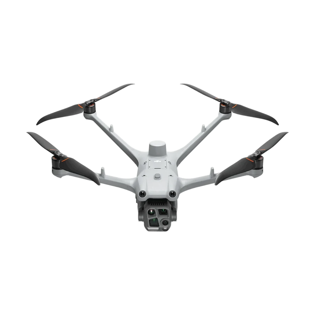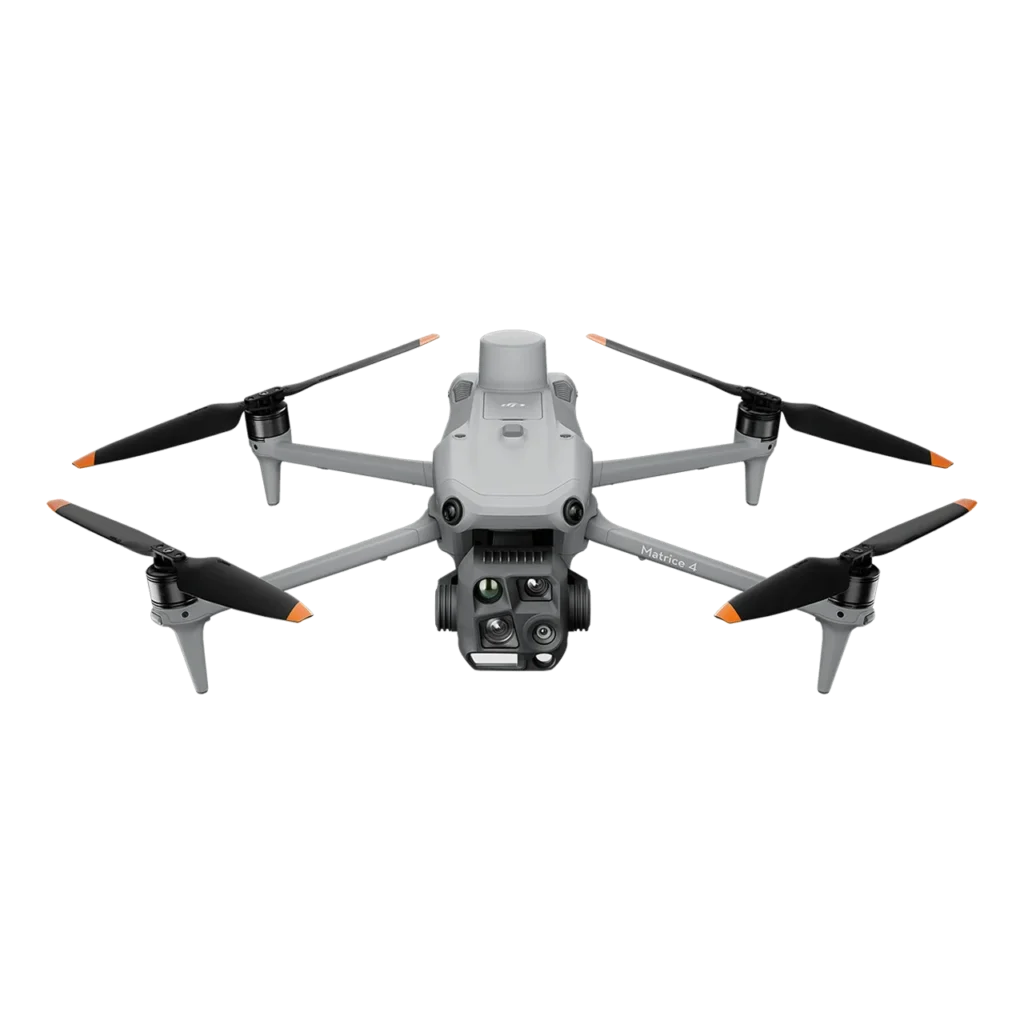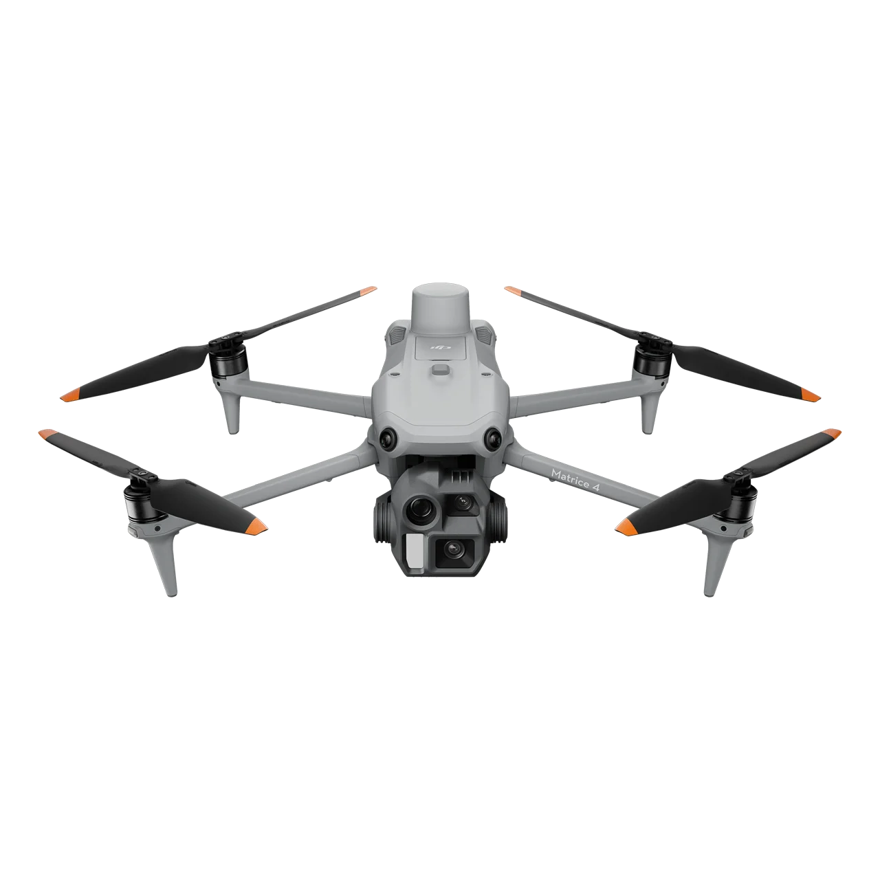
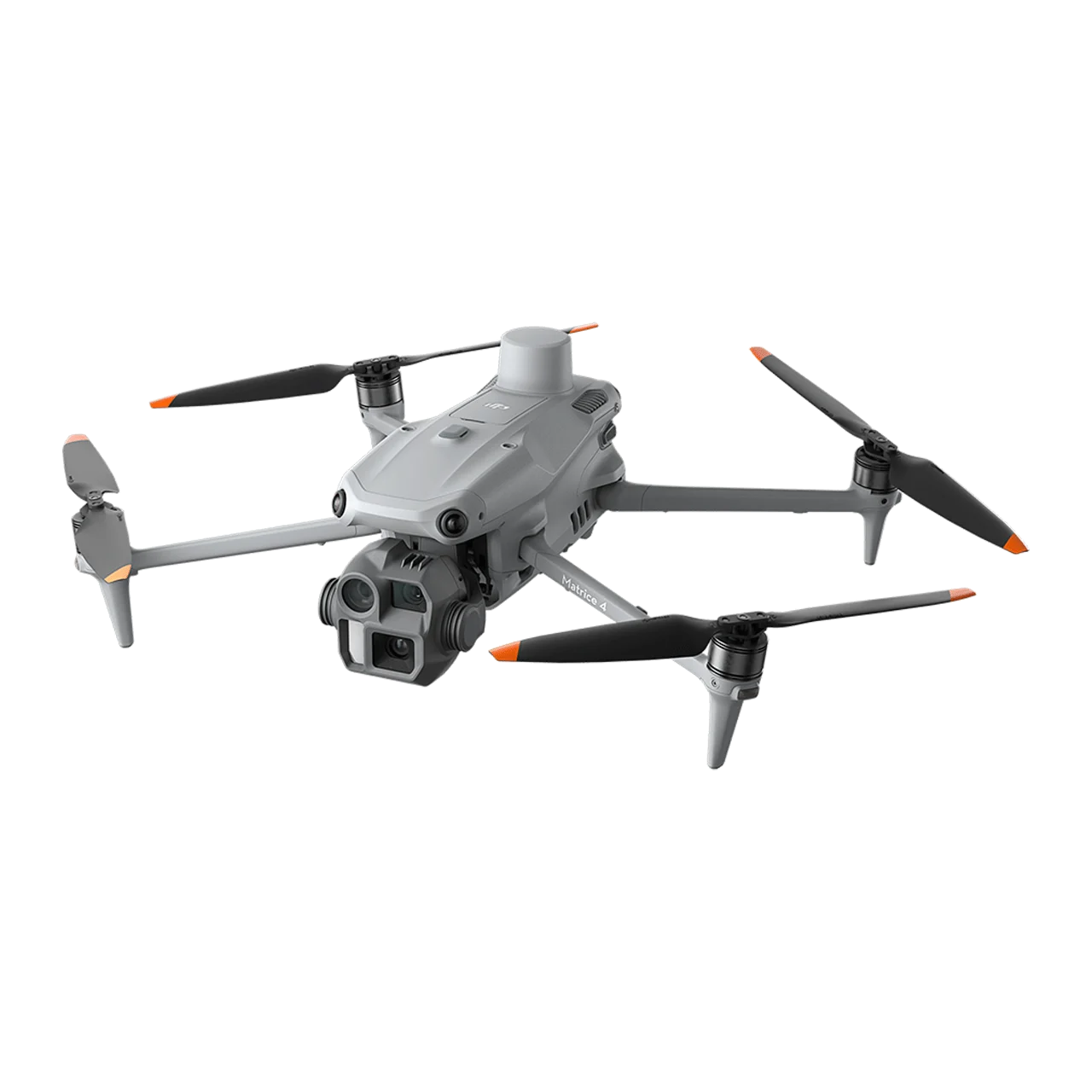
DJI Matrice 4E is a flagship intelligent multi-sensor compact drone specifically engineered for high-precision surveying, mapping, construction, and mining applications. Equipped with a professional 4/3 CMOS 20MP wide-angle camera featuring mechanical shutter, 48MP medium tele camera, 48MP tele camera, and laser range finder, the Matrice 4E delivers exceptional photogrammetry accuracy with rapid 0.5-second interval shooting capability. Supporting advanced mapping workflows including 5-directional oblique capture, 3-directional ortho capture, Smart 3D Capture, and factory-calibrated Distortion Correction 2.0 with residual distortion less than 2 pixels, this enterprise mapping drone achieves mapping flight speeds up to 21 m/s for maximum efficiency. With O4 Enterprise video transmission extending up to 25 km range, integrated RTK positioning, and comprehensive low-light capabilities, the Matrice 4E redefines intelligent aerial surveying operations.
Professional Mapping Camera System
4/3 CMOS Wide-Angle Camera with Mechanical Shutter
- 4/3 CMOS Sensor – Large sensor delivers superior image quality for high-precision photogrammetry
- 20MP Effective Pixels – Optimal resolution for survey-grade mapping applications
- f/2.8-f/11 Adjustable Aperture – Full control over exposure for varying lighting conditions
- 24mm Format Equivalent – Wide field of view ensures efficient area coverage
- Mechanical Shutter – Eliminates rolling shutter distortion for centimeter-level accuracy in photogrammetry
- Rapid 0.5-Second Interval Shooting – High-speed aerial surveying in both orthophoto and oblique photography modes
- Factory-Calibrated Distortion Correction – Each camera undergoes pre-delivery calibration for maximum reconstruction accuracy
48MP Medium Tele Camera
- 1/1.3-inch CMOS Sensor – Professional imaging performance
- 48MP Effective Pixels – Exceptional detail capture for medium-range inspections
- f/2.8 Aperture – Excellent light gathering capability
- 70mm Format Equivalent – Detects screws and cracks from 10 meters distance, clearly reads instrument data at construction sites
- Foreground Stabilization – Keeps subjects stable and clear during telephoto shooting at 10x zoom or higher
48MP Tele Camera
- 1/1.5-inch CMOS Sensor – High-resolution long-range imaging
- 48MP Effective Pixels – Captures details like signs from up to 250 meters away
- f/2.8 Aperture – Superior telephoto performance
- 168mm Format Equivalent – Long-distance inspection and documentation
- Enhanced Clarity – Significantly improved image quality for detailed surveying tasks
Laser Range Finder
- 1800m Measurement Range – Long-distance precision measurement at 1 Hz frequency
- 600m Oblique Incidence Range – 1:5 oblique distance measurement capability
- 1m Blind Zone – Minimal dead zone for versatile measurement scenarios
- Range Accuracy – ± (0.2 + 0.0015 × D) meters for reliable distance data
- Real-Time Precise Measurement – Pin point, line drawing, and area calculation for survey applications
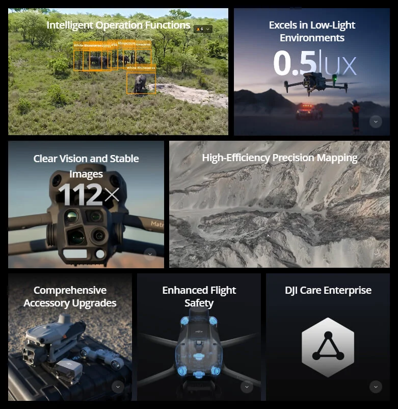
High-Efficiency Precision Mapping Capabilities
Rapid High-Speed Surveying
- 0.5-Second Interval Shooting – Industry-leading capture speed in orthophoto and oblique photography modes
- 21 m/s Mapping Flight Speed – Maximum efficiency for large-area surveying projects
- Multi-Angle Aerial Surveying – High-speed data collection from multiple perspectives
- Time-Saving Operations – Significantly reduced flight time compared to traditional surveying drones
5-Directional Oblique Capture
DJI Matrice 4E supports advanced 5-directional oblique capture technology. The gimbal intelligently rotates and shoots at multiple angles based on the survey area, achieving the effect of multiple camera shots in a single flight compared to previous models, significantly enhancing small drone oblique photography efficiency for comprehensive 3D modeling.
3-Directional Ortho Capture
The Matrice 4E enables 3-directional ortho capture, performing lateral capturing while executing ortho collection tasks to reduce lateral overlap. A single flight can complete mapping operations for an area of 2.8 square kilometers without requiring additional elevation optimization flight routes, achieving superior elevation accuracy. Combined with DJI Terra capabilities, this feature enhances reconstruction efficiency while ensuring survey-grade quality.
Smart 3D Capture – Precision Modeling
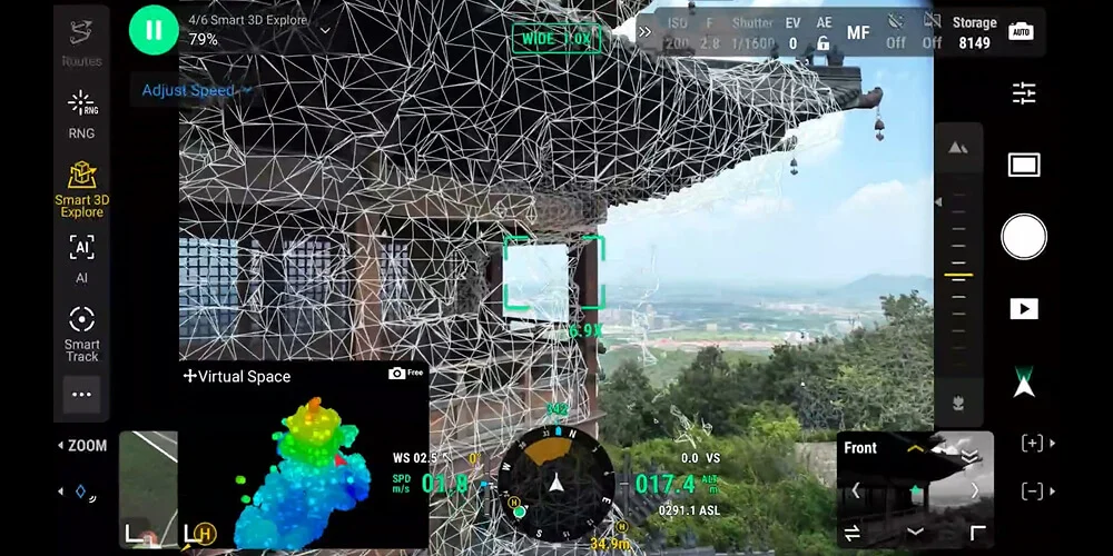
DJI Matrice 4E supports Smart 3D Capture, allowing operators to capture and create a rough model directly on the remote controller. Based on this rough model, the system quickly generates precise mapping routes close to a structure’s surface, completing detailed measurements and modeling of irregular buildings. The system displays virtual space routes and waypoint photos, making it convenient to assess flight safety and coverage area for specific routes.
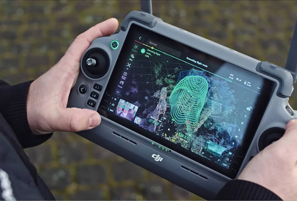
Smart 3D Explore for Modeling
When paired with Manifold 3, Matrice 4E enables Smart 3D Explore for automated modeling. Leveraging Manifold 3’s robust computing power, the system automatically plans safe flight routes within the object’s environment and generates a rough 3D model viewable in real-time on the remote controller. This streamlines close-range photogrammetry workflows and dramatically improves operational efficiency.
Distortion Correction 2.0 – Survey-Grade Accuracy
Distortion Correction 2.0 provides high-precision in-camera distortion correction with residual distortion less than 2 pixels. Each Matrice 4E wide-angle camera is factory-calibrated before delivery. When used with DJI Terra, this technology significantly improves reconstruction accuracy for professional surveying and mapping applications, ensuring centimeter-level precision.
Auto-Generated Surveying Operation Report
Upon operation completion, DJI Pilot 2 automatically generates comprehensive survey quality reports. These reports provide access to key information including photo points, RTK status, and photo parameters. If anomalies are detected, additional photos can be captured on-site to avoid repeated field trips, saving time and operational costs.
Intelligent Operation Functions
Smart Detection and Tracking
- Built-in AI Detection Model – Automatically detects vehicles, vessels, and subjects during surveys or routine flights
- Expandable Model Library – Supports switching to other AI models for expanded application scenarios
- High-Res Grid Photos – Systematic photo capture with grid organization
- Powerful Tracking Capabilities – Smart Track function for autonomous subject following
Efficient Flight Functions
- Cruise Mode – Automated flight path optimization for consistent surveying operations
- FlyTo Function – Automatically adjusts flight path and speed to reach designated locations without manual input
- POI (Point of Interest) – Automated circular flight patterns around structures for comprehensive documentation
- Smart Track – Intelligent subject tracking for dynamic monitoring
Laser Range Finder Measurement Tools
- Pin Point Marking – Precise target location marking for inspection documentation
- Line Drawing – Distance measurement between multiple points
- Area Calculation – Automated area computation for construction sites or mining operations
- QR Code Sharing – Share measurement data via DJI Pilot QR code or FlightHub 2 for enhanced collaboration
Observation Range Recording
DJI Pilot 2 highlights the center position of the camera frame and ground area observed, displaying surveyed areas on the map. This feature is especially useful for construction site patrols and surveying operations in areas without clear landmarks.
Enhanced Low-Light Performance
Night Scene Mode
The Matrice 4E features significantly upgraded night mode with full-color night vision supporting three modes and two levels of enhanced noise reduction. This enables extended operational hours for surveys requiring twilight or nighttime data collection.
Smart Low-Light Photo
Cameras feature larger apertures and intelligent low-light capabilities, significantly enhancing performance during dusk and nighttime operations for flexible surveying schedules.
Low-Light Fisheye Omnidirectional Sensing
Six high-definition low-light fisheye vision sensors significantly enhance visual positioning and obstacle avoidance capabilities in darkness. This allows automatic obstacle avoidance, intelligent rerouting, and safe return-to-home in urban low-light environments, ensuring safe nighttime surveying operations.
Crystal Clear Vision and Stable Imaging
Enhanced Telephoto Capabilities
- Medium Tele Precision – Detects fine details from 10 meters for construction inspections
- Super Resolution Telephoto – 48MP tele camera captures details from 250 meters away
- Foreground Stabilization – Upgraded stabilization keeps subjects clear at 10x zoom or higher
- Detail Visibility – Construction site details clearly visible during telephoto inspections
Electronic Dehazing
In conditions such as smog or atmospheric humidity, Electronic Dehazing supports three modes (Low, Medium, High) to improve imaging clarity, matching different operational environments and requirements for consistent survey data quality.
Safe Flight and Worry-Free Operations
Fusion Positioning with Integrated RTK
The Matrice 4E comes with an integrated DJI RTK module supporting the extended L5 frequency band. Features GNSS+Vision Fusion Positioning and Navigation System, allowing return-to-home point updates through visual positioning. Enables rapid takeoff within 15 seconds and completes return-to-home even without GNSS signals, effectively overcoming signal obstructions in urban environments.
Intelligent Guidance for Unobstructed Flight
- Terrain Elevation Maps – Preload detailed maps when remote controller is connected to internet
- Automatic Path Planning – Intelligent obstacle avoidance route generation
- 5-Directional Vision Assist View – Comprehensive visibility with downward vision for enhanced protection
- Safe Operations – Effective management of nighttime or mountainous area flights
Industry-Leading O4 Enterprise Video Transmission
- 25 km Transmission Range – Extended coverage for large surveying projects
- 8-Antenna System – Enhanced signal stability in challenging environments
- 20MB/s Download Bandwidth – More than double the bitrate of Mavic 3 Enterprise Series
- Precise Route Uploads – Stable image transmission for accurate route planning
- Fast Material Downloads – Efficient data transfer for rapid post-processing
- DJI Cellular Dongle 2 Support – Optional 4G image transmission for enhanced signal stability
Comprehensive Accessory Ecosystem
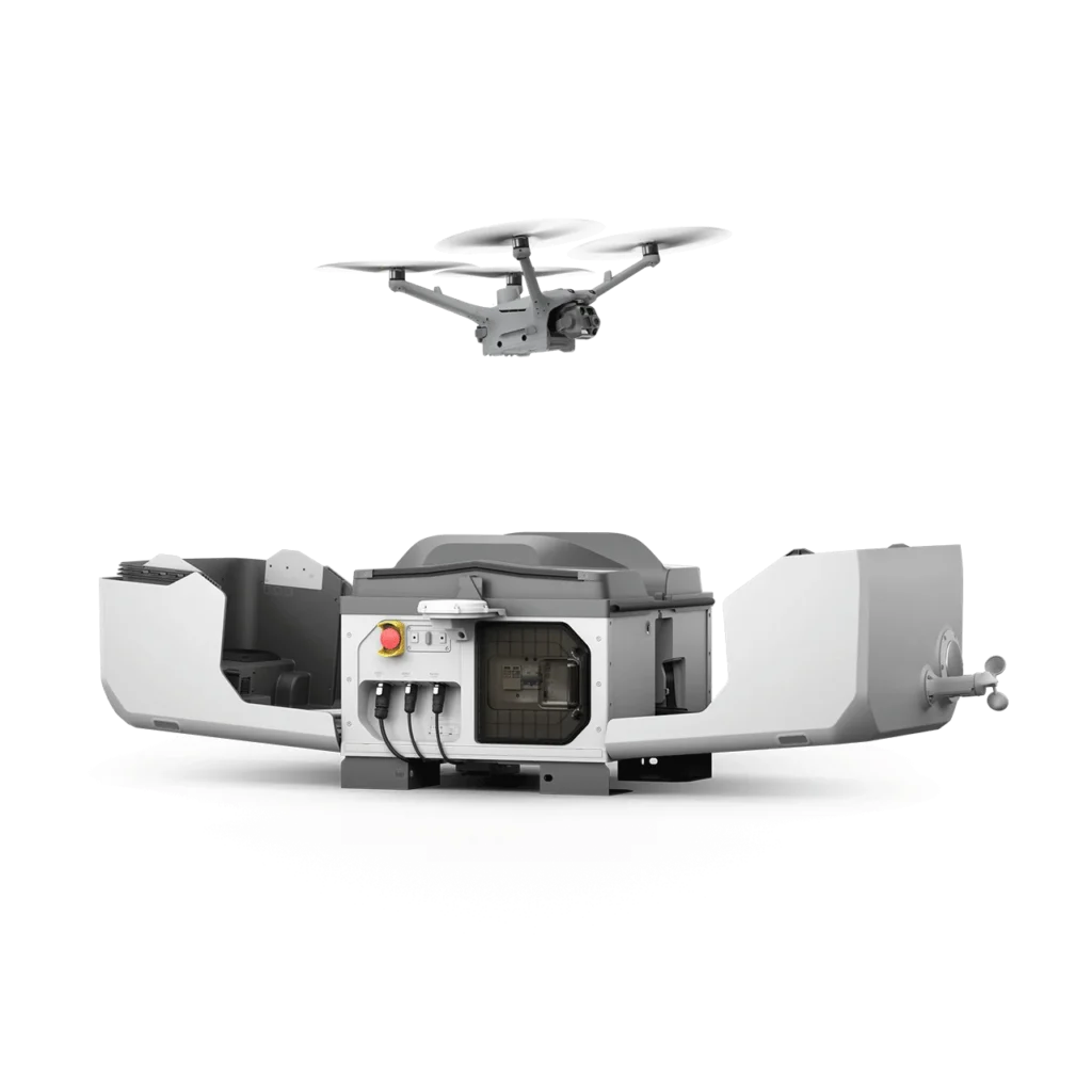
- D-RTK 3 Multifunctional Station – Provides centimeter-level positioning for multiple drones simultaneously, extends operational range in relay mode, and features Rover Station Mode for high-precision aerial surveying
- DJI RC Plus 2 Enterprise – High-brightness remote controller with customizable interface
- DJI Cellular Dongle 2 – 4G connectivity enhancement
- DJI Power 2000 – Extended battery solution for long surveying missions
- Gimbal-Following Spotlight – Optional AL1 Spotlight for low-light operations
Professional Software Integration
DJI Pilot 2
Comprehensively updated interface with customizable intelligent function toolbar supporting various flight route types. Includes virtual space models and route preview functions for convenient and efficient operations. Connects with FlightHub 2 for enhanced control and cloud information sharing.
DJI Terra Integration
Seamless integration with DJI Terra for automated 2D and 3D reconstruction. DJI Terra API allows users to integrate powerful mapping capabilities into custom platforms with customizable photogrammetry workflows tailored to specific survey requirements.
DJI FlightHub 2
Cloud-based fleet management for multi-drone surveying operations with real-time monitoring, data sharing, and collaborative workflows.
Additional Software
- DJI Modify – Mission planning and route customization
- DTAT 3.0 – Data processing and analysis tools
Open Developer Ecosystem
Developer Platform Support
- PSDK (Payload SDK) – E-Port and E-Port Lite encryption authentication for secure third-party payloads
- MSDK (Mobile SDK 5) – Fully open-source with production code samples for custom app development
- Cloud API – MQTT-based protocol for direct third-party platform connection
- DJI Terra API – Integrate powerful mapping capabilities with automated 2D/3D reconstruction
- Intelligent Algorithm Developer Support – Model training tools and certification process for expanding application fields
Data Security and Privacy
- Local Data Mode – Keep sensitive survey data on device without cloud upload
- One-Tap Clear All Device Data – Instant data wipe for security compliance
- AES-256 Video Transmission Encryption – Military-grade encryption for data protection
- Cloud API Security – Secure integration with enterprise platforms
Application Scenarios
- Geographic Information and Surveying – Cadastral surveys, topographic mapping, volumetric calculations, and GIS data collection
- Construction – Site surveying, progress monitoring, BIM integration, and as-built documentation
- Mining Operations – Stockpile volume measurements, pit surveying, and quarry monitoring
- Roads and Bridges – Infrastructure surveys, route planning, and structural inspections
- Water Conservation – Reservoir mapping, watershed analysis, and hydraulic modeling
- Urban Planning – City modeling, land use analysis, and development planning
- Agriculture – Precision agriculture mapping and crop monitoring