Terra Lidar X is a high-precision UAV LiDAR surveying system combining a RIEGL miniVUX series scanner and Applanix APX-UAV series IMU — delivering ±5 cm map-grade accuracy suitable for professional and public surveying standards. Featuring point rates up to 300,000 pts/s, 360° field of view, up to 5 echoes per pulse for vegetation penetration, and a system weight from ~2.0 to ~2.5 kg depending on configuration. Includes unlimited cloud analysis via TerraCloud, next-business-day deliverables, and comprehensive support from Terra Drone’s aerial surveying expert team — designed to maximize drone utilization and cost-effectiveness for surveying companies, construction consulting firms, forestry management, and disaster response.
Why Terra Lidar X?
Many companies have adopted UAV LiDAR but struggle with data analysis complexity, lack of skilled personnel, time-consuming processing, and underutilization of expensive equipment. Terra Lidar X solves these challenges with unlimited cloud-based analysis, expert support, and a survey-to-deliverable workflow that requires no in-house data processing expertise — simply upload your flight data to TerraCloud, and the expert analysis team delivers results by the next business day.
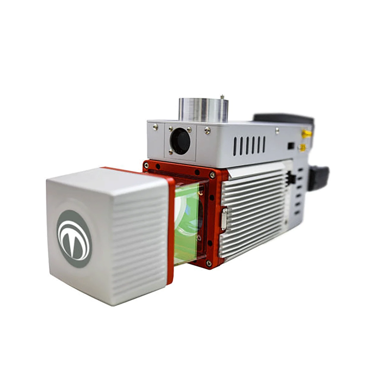
RIEGL miniVUX Series LiDAR Scanner
Developed by Austrian manufacturer RIEGL, with over 30 years of expertise in aerial and ground-based laser scanning. The miniVUX series delivers industry-leading precision in a compact, drone-optimized package.
- Up to 300,000 Points per Second – High-density point cloud for detailed terrain and structural mapping
- 360° Field of View – Complete surround scanning for comprehensive terrain capture
- Up to 5 Echoes per Pulse – Multi-target resolution for penetrating dense vegetation and canopy
- ±5 cm Measurement Accuracy – Map-grade precision for professional surveying
- Scanner Weight: ~1.6 kg | Dimensions: 243 × 111 × 85 mm
- Protection Class: IP64 | Laser Safety: Class 1 (eye-safe)
Applanix APX-UAV Series IMU/GNSS
Developed by Canadian company Applanix, with extensive experience in inertial navigation systems for aerial surveying, ensuring precise direct georeferencing of LiDAR point clouds.
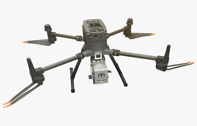
Compatible Drone Platforms
- DJI Matrice 350 RTK – Industry-standard enterprise drone platform
- Build Flyer Chrome – Domestically produced alternative platform
TerraCloud — Unlimited Cloud Analysis
Simply upload your measurement data to TerraCloud, Terra Lidar X’s dedicated cloud analysis service, and the expert aerial surveying team creates your deliverables — original data and accuracy control sheets delivered by the next business day. No need to hire or train data analysis personnel.
- Unlimited Cloud Analysis – Process as many flights as you need without additional cost
- Next Business Day Delivery – Rapid turnaround from data upload to deliverable
- Accuracy Control Sheets – Compliant with professional surveying standards
- No In-House Processing Required – Even operators unfamiliar with data analysis can produce professional results
Comprehensive Support from Aerial Surveying Experts
- Implementation Support – Video lectures, web consultations, and on-site training for smooth introduction
- Operational Support – Flight path review, equipment troubleshooting, and expert consultation
- Order Support – Seminars, latest information, and support website for distributors
- ~90% of Customers utilize drones in 2+ projects within 4 months of implementation
Complete Survey-to-Deliverable Workflow
- Flight Plan Creation – Using proprietary “Planner” software for automated flight paths
- Site Preparation – Ground control marker installation and obstacle check
- Autonomous Flight – Autopilot operation; only takeoff/landing requires manual control
- Data Verification – Immediate on-site check to confirm data acquisition
- Cloud Upload – Send data to TerraCloud analysis team
- Next-Day Delivery – Original data and accuracy control sheet returned
Annual Maintenance & Support
- Cloud Analytics Service (Unlimited) – No per-flight charges
- Maintenance & Calibration – Twice per year for peak accuracy
- Post-Implementation Operational Support – Ongoing expert assistance
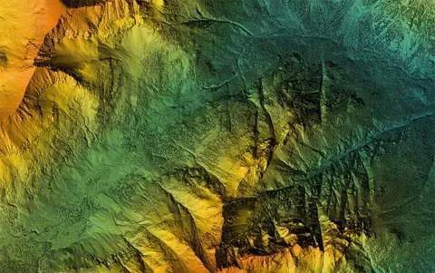
Application Scenarios
- Topographic & Public Surveying – ±5 cm accuracy for map-grade deliverables
- Construction Site ICT Surveying – Progress management with initial and periodic UAV laser measurements
- Forestry Management – Tree density, height, and canopy measurement using multi-echo penetration
- Disaster Response – Rapid post-disaster area assessment and recovery plan support
- Infrastructure & Road Survey – Corridor mapping with high-density point clouds
Trusted by Global Industry Leaders
The Terra Lidar platform is trusted by major energy and industrial organizations including Shell, BP, ExxonMobil, Vopak, TotalEnergies, LyondellBasell, VTTI, and BASF.